
For years the number everyone gave for Phoksundo, the deep blue lake in Dolpa, was about 600 meters, which made it the deepest lake in Nepal. In 2004 the Department of Hydrology and Meteorology measured it. The bottom was at 145 meters. In 2019 the department measured it again and found 136. By 2023 it had also measured Rara, in Mugu, and Rara turned out to be the deeper of the two, at nearly 170 meters.
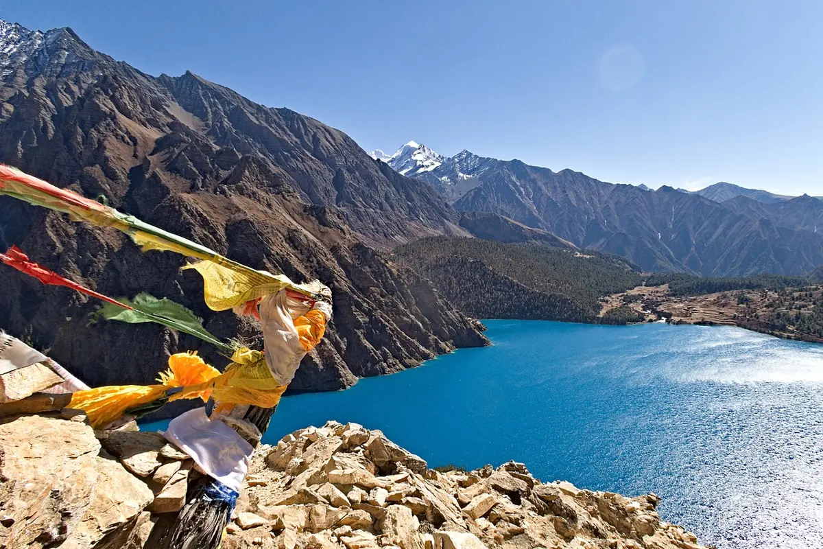
The 600 meters had been an estimate, and nobody had measured. That is true of a surprising amount of what lies on and under Nepal: its soils, its rocks and its ice were described in a few confident lines long before anyone went out and measured them, and much of the measuring has happened in living memory. This chapter is about what that measuring has found.
The plain picture is simple, because it follows the belts of the country from south to north. In the south, the Terai is a plain of mud and sand that rivers have carried down from the mountains. Above it, the Chure hills are made of the same kind of waste, pressed only loosely into rock, and they crumble. The hills behind them are old rock, folded and baked, which the rain has been rotting into soil for a very long time. And the high mountains are mostly rock and ice, with hardly any soil at all. The minerals follow the rocks. The water starts as snow and ice in the north and as rain everywhere, and runs south in rivers that are fed in three different ways.
Soil, from the plains to the snow
The best soil in Nepal is on its flattest ground. The Terai’s farms sit on a topsoil 20 to 30 cm thick, dark brown and crumbly, over a paler loam that is yellow or brown. It drains well, it is mostly a little acidic, more so in the east than the west, and it is the kind of mixed soil, neither sticky clay nor loose sand, that Rock and Soil calls loam. It has the rivers to thank. Every flood that spreads over the plain leaves a fresh coat of mud from the hills, which is how the whole plain was built. Along its top edge, the भाबर (Bhabar), the rivers drop their boulders and gravel first, and the water sinks in, as Nepal from South to North tells.
Then the land rises into the चुरे, and the soil gets worse in a hurry. The Chure’s sandstone, mudstone and conglomerate were never pressed into hard rock. Its lower slopes weather into sandy soil full of holes, which lets water through easily and doesn’t hold a slope well. On the steep, gully-cut parts there is often barely any soil left, only stones. Much of what makes the Chure an argument, later in this chapter, starts with this crumbly ground.
Behind the Chure lie the hills, where most of Nepal’s farmers have always lived, and here the soil is mostly thin and stony, made where it lies from the old metamorphic rock beneath. Some of it, though, is red. In the Jhikhu Khola valley, about 35 km east of Kathmandu, red soils cover about 37% of the land. They are very old and very weathered: rain has had so long to work on them that much of what could dissolve has gone, leaving clay with plenty of iron and aluminum. The iron has rusted, which is the red. These soils soak up rain slowly, so the rain runs off over them, taking soil with it.
High in the mountains, soil is something that happens only here and there. Ice and frost break rock into stones, but cold slows the chemistry and the life that would turn the stones into soil, so what the glaciers leave behind stays rubble for a long time. On the shore of Phoksundo, at about 3,600 meters, the ground is soil mixed with gravel and boulders, and less than 2% of it is rotted plant matter.
All this was mapped only lately. Nepal’s first soil survey was made in 1965, on a forest and a government farm along the road from Nepalgunj to Surkhet, and surveys went on year by year until 1995. A national project mapping the land, finished in 1986, sorted the country’s soils into 14 main groups.
What the rock holds
People in Nepal have been digging for metal for a very long time. Villages called तामाखानी, “copper mine”, and फलामखानी, “iron mine”, are named for it. Nepal sold copper to India in Licchavi times. Under the Ranas, iron was mined at Thoshe in Ramechhap for nearly a hundred years, until ready-made iron became easy to buy in the 1950s. Yet the rocks were explored with any system only from the 1950s, and the Department of Mines and Geology was founded in 1976.
It has since found minerals in more than a thousand places, 64 kinds in all. They follow the belts. The Terai has the hope of oil and gas, deep down. The Chure and the Bhabar have stone, gravel and sand. The hills have most of the metals, along with limestone, dolomite and coal. The high Himalaya has gemstones, zinc and lead, and the dry land behind it limestone, salt and gypsum.
What Nepal actually digs, though, is mostly stone. Boulders, gravel and sand come out of the rivers, which costs little to dig and is in great demand. Slate comes off the hills for roofs. And limestone goes into cement. Cement needs limestone that is nearly pure lime, with little magnesium, and Nepal has plenty: geologists have found it in seven groups of rock across the hills, from Chobhar at the edge of the Kathmandu Valley to Jogimara and beyond, and early studies suggested there could be more than 2.5 billion tonnes of it. By 2011 the government had given out 196 licenses to look for it. In parts of Palpa, limestone companies and the people around them have quarreled over who may dig.
The metals are another story, mostly of waiting. Zinc and lead were proven at Ganesh Himal, but the mine dug there never produced: the ore is far from any road, the deposit is small, and the price of lead fell. Kharidhunga, in Dolakha, holds fine magnesite, for bricks that stand furnace heat, and has stood idle for a long time.
And then there is Dhaubadi. In March 2016 a government survey team reported iron ore in Dhaubadi, in the forest 22 km from the highway in Nawalparasi, which it put at more than 8 million tonnes: the largest iron deposit yet found in Nepal. Since then a state company has been set up to mine it, has drilled test holes, and has proposed digging some 96 million tonnes of ore, and in 2026 the department put the deposit at about 100 million tonnes. The road to the site was still being built. Finding ore, knowing how much is there and how rich it is, and digging it out at a price anyone will pay are three different steps, and Dhaubadi was still on the second.
Petroleum has been the longest wait of all. In Dailekh, at Padukasthan, Sirasthan and Nabhisthan, natural gas has seeped out of the ground and burned for as long as anyone can remember, with a little crude oil, along a stretch of about 14 km. Nepal began looking properly around 1980, and in 2016 agreed with China to explore Dailekh together. From May 2023 a Chinese company drilled a well at Jaljale, close to the old flames, down to 4,013 meters. In February 2026 the China Geological Survey reported about 80.7 billion cubic meters of natural gas there. The report as published doesn’t say whether that is all the gas in the rock or the part that could be brought up, and the well has still to be tested, to learn how fast the gas will flow. Until then nobody can say whether Dailekh will heat a single kitchen. Why Is There Oil in Some Places but Not Others? explains why Nepal’s crumpled rocks are more likely to hold gas than oil.
Ice and lakes
The water starts at the top. In 2010, counted from satellite pictures by ICIMOD and Nepal’s Department of Hydrology and Meteorology, Nepal had 3,808 glaciers, covering 3,902 square kilometers and holding about 312 cubic kilometers of ice. The biggest single glacier is the Ngozumpa, in the Dudh Koshi’s basin, at about 79 square kilometers.
Other inventories count differently, as Ice and Wind shows, and there is a stranger reason the count moves. Between 1977 and 2010 the area of Nepal’s glaciers shrank by about a quarter, and their ice by 29%. Yet the number of glaciers went up by 11%. As a glacier shrinks back up its valley, its branches lose touch with each other, and one glacier becomes two or three. What the shrinking means for rivers is told in The Changing Climate.
Most of Nepal’s lakes are small, and most of the high ones were made by ice. The big three are each a puzzle of their own.
Rara is the largest lake in Nepal: 10.6 square kilometers of water at 2,990 meters, in Mugu, ringed by forest, and almost 170 meters deep at its deepest. How it was made is still argued. One idea, the Swiss geologist Toni Hagen’s, is that a river once flowed through the valley and was captured by the Mugu Karnali, leaving its old course to fill with water. Another is that a glacier carved the hollow, though no glacier’s rubble has been found around it. A third is that an earthquake or a great flood dropped a mass of land across a wide valley and dammed it.
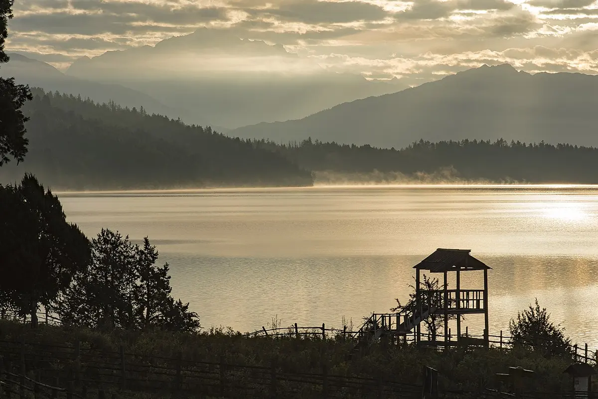
Phoksundo’s origin is better understood. In the last ice age a glacier filled its valley and carved it into a U. When the ice went, one side of the valley, no longer held up, collapsed. A piece of mountain about 2.5 km by 1.5 km fell across the valley floor, some 1.5 billion cubic meters of rock, and the river backed up behind it into a lake. The water leaves through rock at the lake’s southwestern end and falls 167 meters, by one count the highest waterfall in Nepal. Phoksundo covers about 4.8 square kilometers, less than half of Rara.
Tilicho, in Manang, sits higher than either, at 4,919 meters. How deep it is hasn’t been published, as far as we could find.
Three kinds of river
Nepal has some 6,000 rivers and streams, and they come in three kinds, sorted by where they start.
The biggest begin in the high Himalaya and beyond, in snow and ice: the Koshi, the Gandaki and the Karnali. Even in the driest weeks of spring they still carry melt from the mountains, so they never run dry. The second kind begin lower, in the Mahabharat range of the hills: the Mechi, the Kankai, the Kamala, the Tinau, the Rapti and the Babai. They live on rain and springs, so they run high in the monsoon and low in winter, but they keep flowing. The third kind begin in the Chure itself, small rivers like the Ratu, the Sirsiya and the Tilawe. With no snow behind them, they run full in the monsoon and nearly dry up in winter.
So a river’s source decides its year. A farmer by a Himalayan river can count on water in March. A farmer by a Chure stream cannot. Rivers of the World, with its Nepal button, shows every stream in the country colored by the river it leaves Nepal in.
Every one of them flows into India, and that has made Nepal’s rivers a matter between two governments for seventy years. There are three main agreements.
The first, on the Koshi in 1954, is told in Rivers: India built a barrage and embankments on Nepal’s land, for flood control, irrigation and power, and paid for all of it. After Nepal objected to parts of it, the agreement was revised in 1966, and the land under the barrage was leased to India for 199 years.
The second was the Gandak agreement, signed in Kathmandu on 4 December 1959. India would build a barrage on the Gandaki just below the old canal works at Tribeni, at its own cost, and would own and run the works. In return India would build, also at its own cost, canals to water about 40,000 acres in western Nepal and about 103,500 in the east, and a power station of 15,000 kilowatts in Nepal, from which Nepal could take up to 10,000 kilowatts at the cost of making it, and which was to be handed over to Nepal later. Nepal kept the right to draw water upstream, so long as it didn’t harm the project.
The third, the Mahakali Treaty, was signed on 12 February 1996, and it is a different kind of agreement. The Mahakali is a border river for much of its length, and the treaty says so. It sets the water Nepal gets from the Sarada and Tanakpur barrages, and 70 million units of electricity a year from Tanakpur, free, in exchange for 2.9 hectares of Nepal’s land for one bank of the Tanakpur barrage. Its heart is a dam planned at Pancheshwar, upstream, where the river is the border. There, the treaty says, both countries have equal entitlement to the water, the power stations are to be of equal size on each side, the energy shared equally, and the costs divided by the benefits each gets. The dam was expected to make about 6,000 megawatts. The detailed plan for it was supposed to take six months. Sixteen years later it still hadn’t been finished, and thirty years on the dam is still a plan.
The two sides remember these agreements differently. In Nepal, the Koshi and Gandak agreements have long been held up as unequal. When Nepal’s parliament approved the Mahakali Treaty, near midnight on 20 September 1996, the leader of the opposition told it that the Koshi and Gandak treaties “are remembered by Nepalese with sorrows”. The Koshi barrage could water about 1.5 million acres, and about 29,000 of them were in Nepal. People whose land went under water said they were never paid, and India’s control of a barrage on Nepal’s soil was felt as a loss of sovereignty. Even the Mahakali Treaty was approved only after a fight over one phrase: the water is to be shared equally “without prejudice to their respective existing consumptive uses”, and Nepal’s parliament argued over whether that meant half of all the river, or half of what is left after India’s big canals have taken their share.
The view from India, put in the journals of its Institute for Defence Studies and Analyses, starts from what was built. India paid the whole cost of the Koshi project, and irrigation canals and electricity came to Nepal under both agreements. When Nepal objected, India revised the terms: the 1966 Koshi agreement “rectified” certain wrongs, and in 2006 the two sides agreed a cheaper price for Koshi power. On this view the agreements served both countries, their faults came from India’s inexperience in the 1950s, and complaints like the 2008 charge that the Koshi agreement was “unreciprocal” rest on poor knowledge of what has changed since; politics in Nepal has buried the benefits. And a country downstream, these writers point out, finds it hard to give up its claim on water its farms already depend on. Both views are honestly held.
The Chure argument
The Chure covers about an eighth of Nepal, 12.78%, in a long thin band through 37 districts from Ilam to Kanchanpur. The government began a campaign to protect it in 2010, under the President’s name, and in June 2014 it declared the whole belt an environmental conservation area and set up a board to look after it. The board’s case is that the Chure is being stripped: forests cut, too much taken from them, animals grazed freely, land used carelessly. Floods come down out of the hills every year and leave sand and gravel on the Terai’s fields, and water sources are drying up.
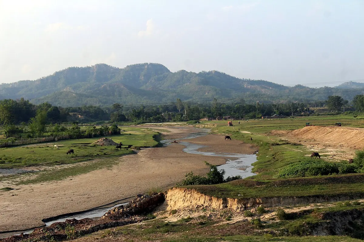
Many people on the plains agree. In August 2019 villagers from Terai districts protested at Maitighar, in Kathmandu. In one village of Dhanusha, they said, wells, hand pumps and ponds had dried up. They wanted the riverbeds left alone, no new settlements in the hills, and no new highway across them. “Chure is a lifeline for people from the Tarai,” one of them said.
People who live in the Chure saw it differently. Within months, thousands of them, many in community forest groups, protested in Makwanpur and Rupandehi. Around five million people might be affected, they said, and nobody had asked them. They had depended on these forests for decades, and the declaration treated them as squatters. Politicians from the three largest parties joined them and called it heavy-handed.
Then there is the stone. The rivers coming out of the Chure carry exactly what builders want. In 2021 the government’s budget proposed exporting stone, gravel and sand, after studies of the harm, to shrink Nepal’s trade deficit with India. Seven petitions went to the Supreme Court, and on 18 June 2021 five judges ordered the government not to carry out the plan while the case was heard. In the end the court called the plan, in effect, ecocide.
Under all three sides lies the question of how much of the Chure’s wearing away is people’s doing and how much is the hills’ own. Loose rock, steep slopes and monsoon rain wear hills down whatever anyone does, as Slopes tells, and the same question was asked of all Nepal’s hills in the 1980s, with surprising answers, in What the Land Gives. Nobody has yet measured it for the Chure well enough to settle the argument.
That is where the measuring of Nepal stands. The lakes have been sounded and the glaciers counted, more carefully every decade. The gas under Dailekh has a number at last, though not yet a meaning, and Dhaubadi’s iron has grown from 8 million tonnes on paper to a hundred. And Phoksundo, for all the years people said it was 600 meters deep, turned out to be a little over a fifth of that.
Found a mistake? Please tell us.