
More lightning strikes Nepal’s Terai than its hills. Receivers that pick up each stroke counted more than a million a year over the country from 2016 to 2020, in the clouds and down to the ground, and they were thickest over the south, the flat plain where most people live. So you would expect the Terai to lose the most people to lightning. It doesn’t. For each person living there, the hill districts lose more than twice as many.
The scientists who mapped this gave the likely reasons, and none of them is about the sky. In the hills, they write, many houses are roofed with thatch, which gives no protection at all. Most people farm steep fields by hand, out in the open, with nowhere solid to run to when a storm builds. And the storms themselves keep different hours: over the plains their worst comes between midnight and early morning, when people are indoors, while over the hills it comes from mid-afternoon into the evening, while people are still out.
The lightning is the same lightning. What differs is who is standing under it, and what they are standing in. That is the whole idea of this chapter, and once you see it in one place you see it everywhere.
A hazard and a disaster
People who study disasters use two words that everyday speech runs together. A hazard is the thing in nature that could do harm: the earthquake, the flood, the bolt of lightning, the leopard at the edge of the village. A disaster is what happens when a hazard hits people and does them so much harm that their lives, their town, their country can’t carry on as before. In Nepali the same pair is प्रकोप, the hazard, and विपद्, the disaster.
The United Nations’ list of these terms, drawn up by a working group of its member countries in 2016, says what turns the one into the other. A disaster comes from a hazard “interacting with conditions of exposure, vulnerability and capacity”. Exposure is simply being in the way: people, houses, roads and crops in the places a hazard can reach. Vulnerability is whatever makes them easier to hurt once it arrives: a house that falls down easily, a family with no savings, nobody knowing what to do. Capacity is the other side of it, everything that helps people cope: a strong house, a warning in time, a neighbor trained in first aid, money to rebuild.
A hazard on its own harms nobody. An earthquake in empty Antarctica is a line on a seismograph. A flood across a plain where nobody lives is a flood. The World Bank’s disaster experts write risk as a multiplication, hazard times exposure times vulnerability, and the point of writing it that way is the zero. Take away any one, and there is nothing left to lose. You can’t stop the Himalaya from shaking. You can choose where to build, and how.
Two earthquakes in 2010
The famous case, the one every book on disasters comes back to, is a pair of earthquakes six weeks apart.
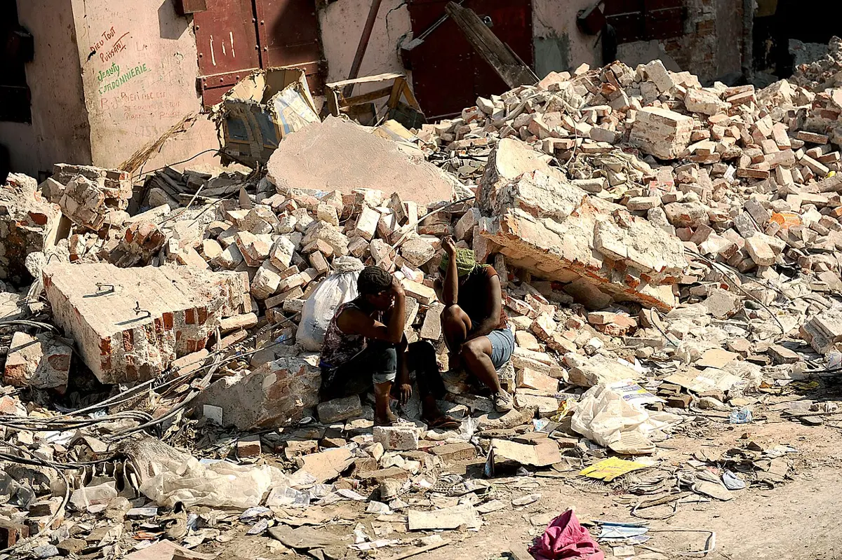
On 12 January 2010 the ground broke under Haiti, about 25 km from its capital, Port-au-Prince. The earthquake was magnitude 7.0, and it started only 13 km down. Nobody knows how many people died. A survey of households in the capital, made six weeks later by researchers who had happened to interview the same families the year before, estimated about 160,000 deaths there alone. The United Nations’ count was over 222,570. On the first anniversary Haiti’s prime minister gave more than 316,000, a figure whose source was never made clear. The estimates are far apart, and none of them can be checked against a full count. Even the lowest of these is one of the worst disasters of modern times.
On 27 February an earthquake of magnitude 8.8 struck off the coast of Chile. On the scale of magnitudes, the 1.8 between them meant about 500 times as much energy let go, as the earthquake chapter worked out for each step. It killed at least 577 people, about half of them in the tsunami that followed.
The US Geological Survey, summing up the year, put the difference down to two things: Chile’s strict building codes, and lower peak shaking. Both matter, and it’s fair to say so. Chile’s earthquake began under the sea, 23 km down, about 80 km from Concepción, its nearest big city, while Haiti’s began shallow, close to a crowded capital. So the hazard was not the same. But Chile’s was far the larger, and Chile had spent decades building for it. Haiti, one of the poorest countries in the Americas, had a capital packed with heavy concrete and brick houses that fell on the people inside. Exposure and vulnerability did the rest. What makes a building stand is the same story in Nepal’s hills in 2015: the shaking seldom kills anyone; what falls does.
Nepal’s count
Nepal keeps a record of its disasters, incident by incident, in the government’s BIPAD portal: every landslide, flood, fire and lightning strike reported by the police and local offices, with the dead, the missing and the houses lost. From 2011 to 2025 it lists about 9,100 deaths in earthquakes, nearly all of them on one day, 25 April 2015. In those same fifteen years it lists about 6,400 more from every other natural hazard: landslides first, then lightning, fire and floods, then wild animals, heavy rain, wind, cold, disease and avalanches.
That second number is easy to miss, because it never comes all at once. A great earthquake is what disaster experts call an intensive risk: rare, sudden, enormous. The rest is extensive risk: small, local, over and over, a family here and three people there, rarely in the national news. Year in, year out, the small ones kill about 430 people a year in Nepal on the portal’s count, some years nearer 300 and one, 2024, nearly 700, and over a lifetime they add up to more than a great earthquake does.
They also keep a calendar. Fire kills most in the cold months, December and January, though the most fires break out in the dry weeks of spring. Lightning comes with the hot, stormy weeks before the monsoon and stays through it, April to June worst of all. Floods and landslides belong to the monsoon, July to September. Cold waves come in December and January, when fog sits for days on the Terai. Wild animals are the only steady thing, a few deaths every month of the year.
Most of these hazards have their own stories in earlier chapters. The landslide of Jure in 2014, and the roads that make so many more. The Koshi that broke out of its banks at Kusaha in 2008. The lakes behind moraines that burst, and the small one above Thame in 2024 that hardly anyone was watching. The tornado in Bara and Parsa in 2019, and the hail of the thunderclouds. Each is a hazard; the chapters say why it happens where it does. Seen together they show what this chapter is about: in nearly every one, the people hurt were the people in the way, in the houses least able to stand it.
Wild animals are a hazard Nepal lives with partly because its parks protect them. Elephants, tigers, rhinos and leopards don’t stay inside the lines. A national study of 2010 to 2014 found about three people killed by large wild animals every month, elephants and leopards most of all, and mostly not in the forest but in villages and on farms, the leopards almost entirely outside the protected areas. The elephants came most in winter, when the rice in the fields stands ready for harvest.
The portal is the best count Nepal has, and it still misses a great deal. Snakebite shows how much. The portal records about twenty deaths a year until 2025, when it records 95. In 2018 and 2019 a team from Geneva and Dharan visited more than 13,000 households in villages chosen at random across the Terai and asked who had been bitten in the past year. Their answer, scaled up to the whole Terai, came to somewhere around 2,400 to 3,200 deaths a year, many of them women and children. It rests on a small number of deaths in the survey, so the true figure could be well off either way, but not by a hundred times. Disease is the same. In 2022 dengue, a fever carried by mosquitoes, was found in all 77 districts, with more than 42,000 confirmed cases and 51 deaths by October; the portal lists no epidemic deaths at all that year. The quiet disasters are the least counted ones.
Warnings that work
A warning doesn’t make a flood smaller. It moves people out of its way, which is exactly the exposure part of the sum.
The great example is Bangladesh, on the delta at the head of the Bay of Bengal. In 1970 a cyclone drove the sea over its low coast and killed perhaps half a million people. Over the next decades the country built cyclone shelters along the coast, embankments and a belt of planted forest, a warning system, and plans for getting people out, and it taught people what to do. In 1991 another killed almost 140,000. Cyclone Sidr in 2007 killed 4,234. Cyclones haven’t got gentler. Fewer people are standing in front of them when they arrive.
Nepal’s rivers give much less time than a cyclone, but sometimes enough. The Karnali leaves the hills at Chisapani, and from there its floodwater takes two or three hours to reach the first big villages downstream. So at Chisapani the river is watched. When it rises past a level worked out from earlier floods, the gauge reader phones and texts a list of people prepared before each monsoon: the district offices, the police and army, local FM stations, and the village committees. Automatic gauges send their own text messages, and sirens on display boards in district offices sound by themselves. In the villages the committees take it from there, with megaphones and sirens, and first-aid and rescue teams make sure the people slowest to move, the old, the disabled, pregnant women and children, are told and helped to safe places, along routes the villagers mapped themselves.
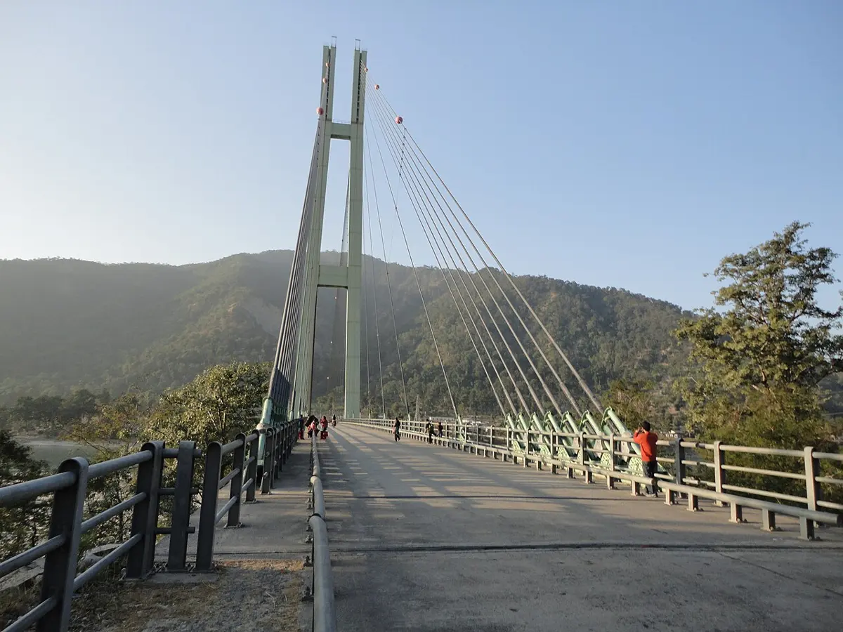
In the floods of August 2014 in western Nepal it worked. Along the Karnali and the West Rapti the warnings arrived, and the villages moved in time, though on the Karnali they had to do it in the dark. The same month, on the Babai, next door, it failed. The flood washed the gauge away. The gauge reader set out to read the river by eye, was trapped between torrents on the path, and broke his phone. Nobody downstream heard anything, and the water reached places that earlier mapping had called safe. More than twenty people died. A warning is only as strong as its weakest link, and that day the weakest link was one man on a trail.
The scientists who studied the Karnali’s system have shown that a forecast from rainfall upstream could add about five hours, making seven or eight in all, though it was still being tested when they wrote. Some hazards give no time at all. Japan’s earthquake warnings beat the shaking by seconds, and only far from the fault, as the earthquake chapter tells. Lightning gives only the thunder. For those, the warning has to be learned in advance, and carried in your head.
What to do
What follows is the advice of the agencies whose job it is. For earthquakes Nepal has its own, from the National Society for Earthquake Technology, NSET, and it agrees with the United States’ emergency agency, FEMA, and its Geological Survey. For lightning, floods and landslides the steps are written out most fully, with their reasons, by the United States’ National Weather Service and Geological Survey, and we give theirs. Nepal’s school books, from Grade 6 on, teach much the same, and for the practical side, step by step, this site has Staying Safe, in Practice and First Aid, in Practice.
When the ground shakes, NSET’s advice is to get under a table or something else strong, not to rush outside in a panic, and outdoors to keep away from walls and gate pillars, which have fallen on people in past earthquakes. FEMA’s is the same, step by step: drop where you are onto your hands and knees, cover your head and neck with one arm, under a sturdy table if one is near, or against an inside wall away from windows, and hold on until the shaking stops. Don’t run outside while it shakes, and don’t stand in a doorway, which is no stronger than the rest of a house. In bed, stay there and cover your head with a pillow. Outdoors, move into the open, away from buildings, trees and wires. Then expect aftershocks. How good is the evidence? Not as good as you might hope. A review in 2021 of what injured people in earthquakes around the world found the records sparse and gathered in different ways, but pointing the same way: people are hurt mostly by falling things, and by falling over while moving. Getting low and covered is the best message the evidence supports. Before any earthquake, fixing tall cupboards and shelves to the wall, and keeping heavy things low, means fewer things to fall.
Lightning’s rule is short: when thunder roars, go indoors. No place outside is safe; a solid building or a car with a metal roof is, a shed or a field hut is not. Wait half an hour after the last thunder before going back out. Like most safety advice, it is experts’ agreement, not something that has been tested in trials. Caught in the open with nowhere to go, get off hilltops and ridges, keep away from lone trees, water and wire fences, and don’t lie flat. The Weather Service says plainly that these steps only reduce the risk. That is the hill farmer’s problem in one sentence, and why lightning researchers in Nepal keep asking for safe shelters in the fields.
Moving water is far stronger than it looks. About 15 cm of fast floodwater can knock over an adult, and about 30 cm can carry away most cars, so the advice is never to walk or drive into it. In Nepal the Department of Hydrology and Meteorology publishes flood forecasts for the big rivers at hydrology.gov.np, and answers a free number, 1155, for weather and flood warnings. For landslides and debris flows the Geological Survey adds what people in the hills learn the hard way. Many deaths come at night, when people are asleep, so stay awake through a night of very heavy rain. Listen for trees cracking and boulders knocking together. A stream that suddenly turns from clear to muddy, or rises or drops without reason, may mean a flow is coming down from upstream, so move at once, and save yourself, not your things.
All of these are for the moment the hazard arrives. Most of what keeps people alive is done long before it: houses that hold together, roads cut so they don’t bring the hillside down, schools out of the river’s way, a gauge reader with a spare phone. Nepal’s Disaster Risk Reduction and Management Act of 2074 BS (2017) made this a job for the government at every level, from the center down to the district and the palika, and a national building code, under the Building Act of 2055 BS, says how a house should be built to stand up to shaking. What that looks like for the place where you live, its slopes and rivers and roofs, is the kind of thing a geographer goes out and looks at. Ask who is exposed, and why they are vulnerable, and the disaster is usually there to be seen before it happens.
Found a mistake? Please tell us.