
Until the 1950s, cars came into the Kathmandu Valley on men’s shoulders. There was no road in, and the Ranas who ruled Nepal wanted motorcars anyway, so each one was driven as far as the road went, to Bhimphedi at the foot of the hills, and carried the rest of the way. The car was lashed onto a frame of logs and bamboo, and a gang of porters in straw slippers lifted it onto their shoulders and walked it over the ridges, by Kulekhani, Markhu and Chitlang, then up over Chandragiri and down into the valley at Thankot. The trip took a week or more, sometimes twelve days, and a big car could need nearly a hundred porters.
One of them was Hira Bahadur Ghalan, a tall Tamang man from a village near Tistung, who came to lead gangs of thirty and more. When he started, and for how long he carried, the accounts of his life don’t agree. One of the cars carried by the men of his hills was a Daimler-Benz given to King Tribhuvan, which is now in the Narayanhiti palace museum.
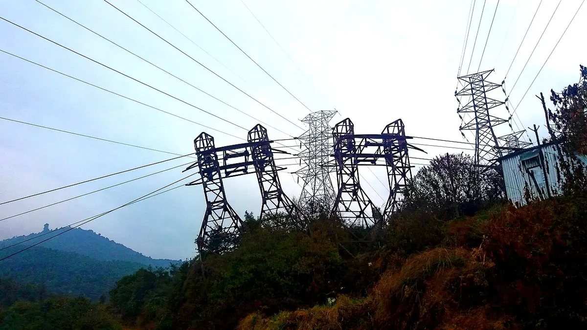
Inside the valley those cars had a few paved streets to drive on and nowhere else to go. Everything the valley bought from outside came the same way, on somebody’s back, or, after 1925, swinging along a cable over the hills. That cable, a ropeway built for the Ranas by a London firm, ran from Dhorsing, near Bhimphedi, to Thankot, in seven sections on more than a hundred steel towers. Its buckets each carried about a quarter of a ton, and in 1945 it carried about 55 tons a day. Ten years later, three-quarters of what it brought in was food.
The road came next. In 1952 an Indian army team began a road from Kathmandu south over the hills toward Bhainse, without even a signed agreement. By 1953 a jeep could get through; by the end of 1956 trucks and buses could, on gravel, over a pass at Sim Bhanjyang, 2,504 meters up. It was named the Tribhuvan राजपथ (Rajpath, the king’s road), and the first regular bus, in April 1957, took fourteen hours from Amlekhganj. From 1961, trucks could drive straight from the Indian border town of Raxaul to the capital. The car porters were out of work. Hira Bahadur’s son, Maila Kaji Lama, became a driver.
This chapter is about what came after: the roads, runways, wires and phone towers that now cover most of Nepal, and the schools and health posts at the ends of them. It is also about the people they haven’t reached yet, because the map of who is near and who is far is one of the plainest maps of who is better off.
Distance in hours
To most Nepalis, how far away something is has never been a matter of kilometers. It is a matter of time: two hours’ walk to the market, half a day to the district headquarters. Geographers have come round to the same view. What matters about a school or a clinic is not how far it is as the crow flies but how long it takes to get there, and that depends on the slope, the river in between, the season and whether a bus goes that way.
So that is how Nepal’s national household surveys have measured it. Four times since the 1990s, in 1995/96, 2003/04, 2010/11 and 2022/23, the Nepal Living Standards Survey has asked thousands of households the same questions, among them: how long does it take to reach the nearest paved road, school, health post or market, by the usual way of getting there? The answers make the best single picture of how Nepal has changed.
In 1995/96, one household in four lived within half an hour of a paved road. In 2022/23, four in five did. Hardly anything about Nepal has changed faster.
The roads behind that change grew in two layers. The country’s main roads, the highways and feeder roads the Department of Roads looks after, came to 4,740 kilometers in 1998, and 2,905 of them had a hard top. Twenty years later the same network was 13,448 kilometers, about half of it blacktopped. Under that layer came the rural roads that local governments and villagers have cut themselves, several times longer than the main network and mostly dirt, many of them bulldozed along a hillside, which is why so many slip away every monsoon (Why the roads and the landslides go together).
One district headquarters after another joined the network. By 2015/16 every one of them could be reached by road except two, in the far northwest: Dolpa and Humla. Humla’s took almost thirty years. Work began in 1997, after a famine and an outbreak of flu; the Nepal Army took the job over in 2015 and finished the track in 2024; and in July 2025, when the army had put a steel bridge over the Chuwa Khola in thirty-five days, vehicles could drive all the way to Simikot for the first time, and on to Hilsa on the border with Tibet, 505 kilometers from the Indian border at Rupaidiha.
Being on the network is not the same as being close to it. The surveys still find two Nepals. In the towns of the Kathmandu Valley, 99.6% of households are within half an hour of a paved road. In the countryside as a whole, 55.5% are. In Karnali Province, the country’s largest and emptiest, 35% are, and nearly one household in five is more than three hours away. Poorer households are farther out than the better off, 67% within half an hour against 83%, and each fact feeds the other: a road brings buyers, wages and cheaper goods, and the places it hasn’t reached stay poor, which is part of the story told in Near the market, or near the mine.
Nepal has tried rails as well as roads, never for long. The line from Raxaul to Amlekhganj, opened in 1927, is in The way to the sea; a narrow-gauge line from Jaynagar in India to Janakpur opened ten years later, was cut short by floods in 2001 and stopped in 2014. A broad-gauge line on the same route opened in April 2022, running 34.9 kilometers to Kurtha.
The ropeway had its successor too. In 1964 an American-built cable from Hetauda to Teku replaced it, 42 kilometers long. It stopped in 1998, when two transformers failed and were never mended, was closed for good in 2001, and stands derelict now. The cable cars that run today carry pilgrims and sightseers, to Manakamana, up Chandragiri and to Kalinchok.
Runways on the hillside
Where the roads stop, Nepal flies. The Civil Aviation Authority counts about fifty-five airports, of which about two-thirds are in use. Before Humla had its road, the only way to Simikot that didn’t take days of walking was to fly.
The planes that fly to the mountain strips are built for it. Short takeoff and landing aircraft, such as the Twin Otter, the Dornier 228 and the Czech-built Let 410, can climb out steeply and stop within a few hundred meters.
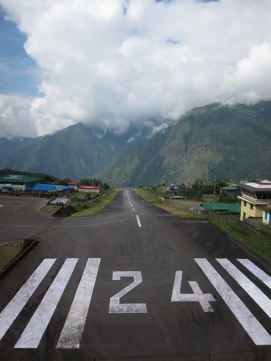
The best known is at Lukla, the airstrip that most people heading for Everest fly into. Edmund Hillary had it built in 1964; it was paved in 2001. It is 527 meters long, about as far as you could walk in seven minutes, at about 2,845 meters above sea level, and it slopes, climbing almost 12 meters for every 100. Planes always land uphill, which slows them down, and take off downhill, which speeds them up. They have to, because there is no going round for a second try. At the top of the runway the mountain rises in a wall, and at the bottom the ground drops away into the valley.
Hira Bahadur Ghalan’s grandson is a pilot. In 2026 he was flying Let 410s for a Nepali airline to strips like Lukla and Simikot. His grandfather walked cars over the hills; he flies over them.
Wires
In 1995/96, one Nepali household in seven had electricity. In 2022/23, 94 in a hundred did. That is the other line on the survey’s chart, and it rose even faster than the roads.
Nepal’s first power station, at Pharping in 1911, and the rivers that most of its power has come from since are in Falling water. For years there wasn’t enough of it. In the dry winters, when the rivers run low and the power stations with them, the power was cut for up to eighteen hours a day. The cuts ended for homes, starting in the capital, in the winter of 2016/17, and for industry in May 2018. By 2025/26 the Nepal Electricity Authority counted 4,120 megawatts of power stations, and the country sold more electricity to India than it bought.
The wires still don’t reach everyone. In the Terai’s Madhesh Province, 98.5% of households have electricity; in Karnali, 58%, and among Karnali’s poorer households fewer than two in five. Of Nepal’s 753 local governments, eighteen are still off the national grid altogether. For Karnali the electricity authority plans small solar plants with batteries, in Mugu, Dolpa, Jumla and Humla, and a line from Surkhet through Dailekh and Kalikot to Jumla.
For all that, Nepal’s record is better than much of the world’s. About 660 million people still lived without electricity in 2024, and nearly nine in ten of them were in Africa south of the Sahara, where fewer than six people in ten had it.
The newest wires are the ones you can’t see. Nepal now has more mobile subscriptions than people, about 30.3 million for 29.2 million, which means that many people carry more than one. Internet at home is another matter. In the census of 2011, 3% of households had it; in 2021, 38%. The household survey found 60% of households in Bagmati Province with internet and 14% in Karnali, and 46% of better-off households against 10% of poor ones. A government fund for rural telecommunications has paid to bring broadband to 5,318 community secondary schools and 4,249 places of health care, among others.
Who is still far
The same surveys asked how long it takes to reach a school and a health post.
Schools are the nearest of all. Nine households in ten have a basic school, Grades 1 to 8, within half an hour; the average walk is fourteen minutes. In the towns of the Kathmandu Valley it is four and a half. In Karnali it is closer to half an hour, and one household in four is farther than that. The farther up the ladder, the bigger the gap. A secondary school is within half an hour for 95% of households in Madhesh but 52% in Karnali, and a college or university for 75% of households in Bagmati but 24% in Karnali.
Health care is farther still. For the country as a whole, the nearest health post is half an hour away on average. In Madhesh, it is thirteen minutes. In Karnali, it is an hour, and for about a third of Karnali’s households more than that. A primary health center is within half an hour for 45% of Nepal’s households and 11% of Karnali’s; a government hospital, for fewer than half of all households.
Put every one of the survey’s maps side by side, roads, wires, internet, schools, clinics, and the same province keeps coming out farthest: Karnali, steep, thinly settled, a long way from the plains. That is not an accident. A road, a power line or a health post costs much the same to build whether it serves a hundred people or ten thousand, and in the Terai and the valley ten thousand people live close enough to share one. In the mountains, the same money reaches a fraction of the people, and the slopes take it back every monsoon. So the networks reached the flat and crowded places first, and are still reaching the steep and empty ones, which is the pattern behind the numbers in Uneven numbers.
Hira Bahadur Ghalan carried cars over the hills into the one place in Nepal that had streets to drive them on. His grandson flies over the same kind of country, to places like Simikot, whose road came only in 2025.
Found a mistake? Please tell us.