
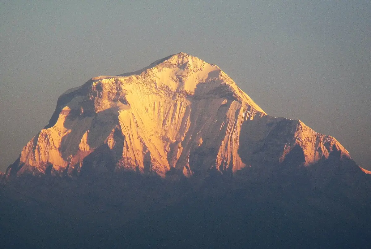
Every morning, before sunrise, hundreds of trekkers climb Poon Hill, above Ghorepani in Myagdi, to watch the sun light up the Himalaya. A guide points: “Dhaulagiri is to the north-west, and the Annapurnas are to the north-east.”
But from Poon Hill, three famous peaks lie to the north-east: Annapurna I, Annapurna South and Machhapuchhre. “North-east” can’t tell them apart. How could the guide name one exact direction for each peak? And how could you draw all four on one page of your exercise book, when the farthest is about 38 km away?
This unit answers both questions. A bearing gives a direction as one number. A scale lets a whole court, a village or a country fit on paper. In Back to Poon Hill you will give each peak its own bearing and its real distance.
20.0 Review
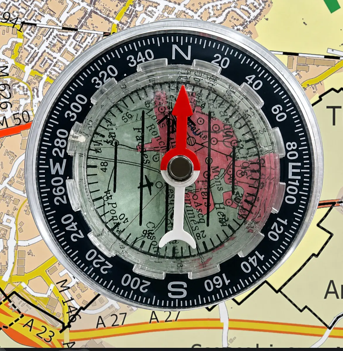
A compass has a needle that is a small magnet. It turns freely, and wherever you stand, its red end points to the north. Once you know where north is, you know every other direction.
The four main directions are North (N), East (E), South (S) and West (W). Halfway between them are four more: North-east (NE), South-east (SE), South-west (SW) and North-west (NW).
20.1 Bearing
Eight directions are useful, but they are rough. A place that is a little east of north-east is still called “north-east”. To say the direction exactly, we use the angle, measured in a fixed way.
So the eight directions have these bearings:
| Direction | Bearing | Direction | Bearing |
|---|---|---|---|
| North | 000° | South | 180° |
| North-east | 045° | South-west | 225° |
| East | 090° | West | 270° |
| South-east | 135° | North-west | 315° |
A bearing can be any angle from 000° up to 359°. A full turn, 360°, brings you back to north.
A place lies exactly to the south-east of you. What is its bearing?
Pick an answer to see why.
Which of these is written correctly as a bearing?
Pick an answer to see why.
20.1.1 Map reading
On a map, north is usually straight up. To find the bearing of a place from another:
- Draw a north line, straight up, at the place you are measuring from.
- Join the two places with a straight line.
- Put the protractor’s center on the starting place and its 0 on the north line. Measure the angle clockwise from north to the line.
- If the angle is bigger than 180°, measure the angle the other way and take it away from 360°. (A half-circle protractor only reaches 180°.)
If you have no protractor to hand, use this one. Drag the yellow ring round the municipality building: the line snaps onto a place when it points at it.
From a school, a temple is due west. What is the bearing of the temple from the school?
Pick an answer to see why.
20.2 Scale drawing
A football ground is about 100 m long. Your exercise book is about 25 cm long. To draw the ground on the page, every length must be made smaller, and all by the same number of times, so that the drawing keeps the ground’s shape. That is a scale drawing. The number of times is the scale.
Try it below. Choose a court, a ground or a room, then a scale. Watch what happens to the drawing on a sheet 15 cm by 10 cm.
On a map, 1 cm = 200 m. Two shops are 4 cm apart on the map. How far apart are they really?
Pick an answer to see why.
A drawing is made at 1 cm = 5 m. How long is a wall 30 m long on the drawing?
Pick an answer to see why.
Exercise 20
Question 1
Eight students stand on the school ground, one at the end of each arrow, as in the figure. North is straight up. Utsab stands to the north.
What is the bearing of the place where Dorje is standing?
Answer
What is the bearing of the place where Rehan is standing?
Answer
Question 2
Answer the questions from the figure. North is straight up. Measure with a protractor on the figure, or with the one under it.
Find the bearing of A from O.
Answer
Find the bearing of C from O.
Answer
Find the bearing of F from O.
Answer
Find the bearing of B from O.
Answer
Question 3
Study the real map of Nepal and answer the questions. On the map below, choose where to measure from, and drag the yellow ring.
Write the bearing of Nepalgunj from Pokhara.
Answer
Write the bearing of Manang from Kathmandu.
Answer
Write the bearing of Taplejung from Janakpur.
Answer
Question 4
Find the real distance between two places.
The distance between them on a map is 9 cm, and the scale is 1 cm = 200 m.
Answer
The distance between them on a map is 3.5 cm, and the scale is 1 cm = 500 ft.
Answer
Question 5
A ground is 125 m long and 75 m wide. Draw it to a scale of 1 cm = 10 m.
Answer
Question 6
1 cm stands for 2 feet. Draw a plan of a room 20 ft long and 18 ft wide.
Answer
Question 7
The figure of an electric pole is drawn to a scale of 1 : 100. Find the real height of the pole.
Answer
Question 8
Stand with your friends on the school ground, as the students stand in Question 1. Find the bearing of each friend from the middle. Then call each friend by their bearing.
Answer
Project work
Mixed exercise
Question 1
Find the values of x and y in the figure.
Answer
Which angles in the figure are equal?
Answer
Does the figure have point symmetry or line symmetry?
Answer
Question 2
Plot the points A(−4, 2), B(4, 3) and C(2, 5) on graph paper and join them in order. Name the figure you get.
Answer
Write the coordinates of A′, B′ and C′, the images of A, B and C after reflection in the X-axis.
Answer
Why are triangles ABC and A′B′C′ congruent?
Answer
Is there a rule for the reflection of ABC into A′B′C′? Can you write it as a formula?
Answer
Question 3
A rectangle is 4 cm long and 3 cm wide. What is the length of its diagonal? Is the diagonal a line of symmetry of the rectangle? Give a reason.
Answer
Question 4
1 cm stands for 10 m. Draw a football ground 90 m long and 45 m wide. What kind of angles are at its four corners? If the diagonal is taken as a mirror line, what figure do you get?
Answer
Question 5
The capital letter V has one line of symmetry, and H has two. Find the other capital letters of the English alphabet that have a line of symmetry, and list them. Which of them also have point symmetry?
Answer
Question 6
The points P, Q, R and S are marked on the grid.
Write the coordinates of P, Q, R and S, and of their images in the X-axis and in the Y-axis.
Answer
Question 7
A vehicle is at S, 200 km east of the point T. It travels 300 km west from S to the point U. Find, by a scale drawing:
the distance between T and U
Answer
the bearing of T from U
Answer
Question 8
Find the bearing of each place from Kathmandu. Drag the yellow ring round Kathmandu on the map; the line snaps onto a place when it points at it. The places on this map are where they really are, so the answers below are their true bearings. A hand-drawn sketch map may put some of them in other directions (Devghat, for example, is almost due west of Kathmandu): on a sketch, measure on the sketch.
Gosaikunda
Answer
Tatopani
Answer
Devghat
Answer
Dolakha
Answer
Palanchok Bhagawati
Answer
Panauti
Answer
Janakpur
Answer
Question 9
The main places of a village are shown in the figure. The scale is 1 cm = 100 m. North is straight up.
Find the real distance of each place from the health post. The answers use the lengths marked on this drawing; with another drawing, measure each line with a ruler and multiply by 100 m in the same way.
Temple
Answer
Source of water
Answer
School
Answer
Hat bazaar
Answer
Post office
Answer
Write the bearings of the school, the hat bazaar and the post office from the health post.
Answer
What are the bearings of the temple and the school from the health post?
Answer
Printable PDFs
- Study notes 2 pages
- Harder practice questions 2 pages Answer key
Practice every question in the book, and keep track of the ones you miss →
Back to Poon Hill
Worked out from the peaks’ positions on the map, these are the bearings and straight-line distances from Poon Hill:
| Peak | Bearing | Distance |
|---|---|---|
| Dhaulagiri | 330° | about 38 km |
| Annapurna I | 030° | about 25 km |
| Annapurna South | 041° | about 17 km |
| Machhapuchhre | 067° | about 28 km |
All three of the north-eastern peaks now have their own number: 030°, 041° and 067°. With a compass, a trekker can turn to 067° and know that the sharp peak in front is Machhapuchhre.
Drawn on paper at the scale 1 cm = 5 km, all four peaks fit on one page: Dhaulagiri’s line is 38 ÷ 5 = 7.6 cm long, and Annapurna South’s only 17 ÷ 5 = 3.4 cm. Going the other way, measure a line on such a drawing with a ruler and multiply by 5, and you have the real distance.
Where this is used
- Flying. A runway is named by a number from 01 to 36: its direction, measured from north like a bearing, in tens of degrees. Grade 8 explains how.
- Trekking and rescue. With a map and a compass, a trekker in cloud can walk on a bearing to reach a safe place.
- Maps. Every map has a scale, printed on it as a ratio, a line marked in kilometers, or both, so distances can be measured from it.
- Building. An architect’s plan of a house is a scale drawing, often at 1 : 100: 1 cm on the plan is 1 m of the real house.
- Sport. Courts and grounds are marked out from scale plans like the volleyball court in Activity 3.
Where these facts come from
- Poon Hill and the peaks: Wikipedia, “Poon Hill” (28.400 N, 83.690 E), “Dhaulagiri” (8,167 m), “Annapurna” (Annapurna I), “Annapurna South” (7,219 m) and “Machapuchare”, their coordinates, read November 2026. The bearings and distances were worked out from these coordinates on the round Earth. How high each peak rises in the sky was worked out too, from Poon Hill’s height (3,210 m, same article): Annapurna South about 13° above level, Dhaulagiri about 7°.
- The map of Nepal and the places round Kathmandu: district borders from this site’s 77 Districts map; places from Wikipedia (Pokhara, Nepalgunj, Phungling for Taplejung, Charikot for Dolakha) and OpenStreetMap (Manang, Basantapur in Kathmandu, Janaki Mandir in Janakpur, Gosaikunda, Tatopani, Devghat Dham, Palanchok Bhagawati temple, Panauti), read November 2026. Bearings and distances worked out on the round Earth.
- The volleyball court: Wikipedia, “Volleyball” (court 9 m × 18 m; the attack line 3 m from the net), read November 2026.
- Runway numbers: Wikipedia, “Runway”, Naming (a number from 01 to 36, the runway’s heading in tens of degrees, measured from magnetic north), read November 2026.
- Scales of building plans: Wikipedia, “Architectural drawing” (plans at 1 : 100, or 1/8 inch to 1 foot), read November 2026.
A companion to your textbook, not a replacement for it: study from the book your school uses, and where the two differ, follow your teacher. Found a mistake? Please tell us.