
There are no roads in the sky and none on the sea. So how does a pilot leaving Kathmandu know which way to go? And why is Kathmandu’s runway painted 02 at one end and 20 at the other?
Saying “north-east” is too rough for a pilot: over 500 km, a small mistake in direction misses a city. One number is needed for the direction, and it has to mean the same thing to everyone. That number is a bearing. The second half of this unit answers the next question: once you have directions and distances, how do you fit a whole route, a field or a country on one sheet of paper? That is a scale drawing.
20.0 Review
You know the four main directions, north, east, south and west, and the four between them. On a map, north is usually at the top.
Part b is the idea of this unit. A word gives eight choices. A number of degrees gives 360, and more if you need them.
20.1 Bearing
Each place needs only one number, and the number means the same to everybody: start facing north and turn clockwise. The international airport is at about 061°, the National Botanical Garden at about 140° and Swayambhunath at about 336°.
The direction of an object or place, given as the angle turned clockwise from the north line, is called its bearing. It is always written with three digits.
So 5° is written 005° and 50° is written 050°. Pilots and sailors steer by bearings, because the sky and the sea have no roads to follow.
Every bearing needs three things: a place to measure from, a north line at that place, and a clockwise turn. That is why we say “the bearing of the airport from the zoo”. Swap the two places and the bearing changes.
A place lies due south-west of you. What is its bearing?
Pick an answer to see why.
The bearing back
If Mithila’s house is on a bearing of 050° from the school, what is the school’s bearing from Mithila’s house? It isn’t 050° again: from the house, the school is in nearly the opposite direction.
There is a shorter way. Standing at S and looking at R, you face exactly the opposite way from someone at R looking at S. Opposite means half a turn: . So:
- If the bearing is less than 180°, add 180°.
- If the bearing is 180° or more, take away 180°.
The bearing from the other end is often called the back bearing. Try it below. However you turn the line, the two numbers stay 180° apart.
The bearing of a town from a school is 280°. What is the bearing of the school from the town?
Pick an answer to see why.
Exercise 20.1
Question 1
No protractor with you? Choose a figure here and read it from the protractor laid on it.
Measure the angle in the figure, and write the bearing of place B from place P.
Answer
Measure the angle in the figure, and write the bearing of place B from place P.
Answer
Measure the angle in the figure, and write the bearing of place B from place P.
Answer
Measure the angle in the figure, and write the bearing of place B from place P.
Answer
Question 2
Draw a point A with a north line. Find a place from A on each of these bearings.
- a.030°
- b.090°
- c.125°
- d.260°
- e.285°
- f.340°
Answer
Question 3
Choose a figure, then From and To, to read each bearing.
With the help of a protractor, find the bearing of Y from X. Also find the bearing of X from Y.
Answer
With the help of a protractor, find the bearing of Y from X. Also find the bearing of X from Y.
Answer
With the help of a protractor, find the bearing of Y from X. Also find the bearing of X from Y.
Answer
Question 4
The bearing of your school from your home is 045°. Find the bearing of your home from the school, and draw the figure.
Answer
In a classroom, the bearing of Anjali’s place from Rita’s place is 100°. Find the bearing of Rita’s place from Anjali’s, and draw the figure.
Answer
The bearing of the village temple from your school is 190°. Find the bearing of the school from the temple, and draw the figure.
Answer
The bearing of Kathmandu from your district headquarters is 265°. Find the bearing of your district headquarters from Kathmandu, and draw the figure.
Answer
The bearing of the health post from your house is 065°. Find the bearing of your house from the health post, and draw the figure.
Answer
Question 5
Use the figure to answer.
- a.What is the bearing of B from the point A?
- b.What is the bearing of C from the point B?
- c.What is the bearing of M from the point A?
- d.What is the bearing of X from the point A?
- e.What is the bearing of C from the point A?
Hint
Answer
20.2 Scale Drawing
A scale tells how a length in a drawing stands for a length in the real thing.
- Very big things, and very small ones, can be drawn on a sheet by using a scale. A country shrinks; a bee’s eye grows.
- We take every measurement of the real thing and multiply it by the same number, so the drawing keeps the same proportions.
- We can then go the other way, and find a real measurement from the drawing.
A scale can be written in three ways, and all three say the same thing. Say 1 cm on a map stands for 500 m:
- In words: 1 cm = 500 m.
- As a ratio: 500 m is 50,000 cm, so the scale is 1 : 50,000. A ratio has no units: 1 of anything on the map is 50,000 of the same thing on the ground.
- As a bar: a line marked with what it measures on the ground, like those in Figure 20.22.
Every distance then follows one rule:
To draw something, go the other way: divide the actual distance by what 1 cm stands for. And every angle stays exactly as it is. A map shrinks lengths, not bearings: the corner of a field is a right angle on any map of it.
A plan’s scale is 1 : 100. A wall on the plan measures 4.5 cm. How long is the real wall?
Pick an answer to see why.
Try the same slips below. Then press Your own and make a route. Notice that a list of slips is all the instructions a pilot needs, and that the last readout tells you the way home.
Back to the runway
Now the numbers at Kathmandu make sense. A runway is named by the direction a pilot faces along it, in tens of degrees clockwise from north: the bearing to the nearest 10°, with the last zero left off. Landing over the number 02, you are heading about 020°. Landing from the other end, over the 20, you are heading about 200°.
The two numbers differ by 18, which means 180°. They are the bearing and the bearing back of one straight line. Runways everywhere are named this way: the number at one end is the other’s plus or minus 18.
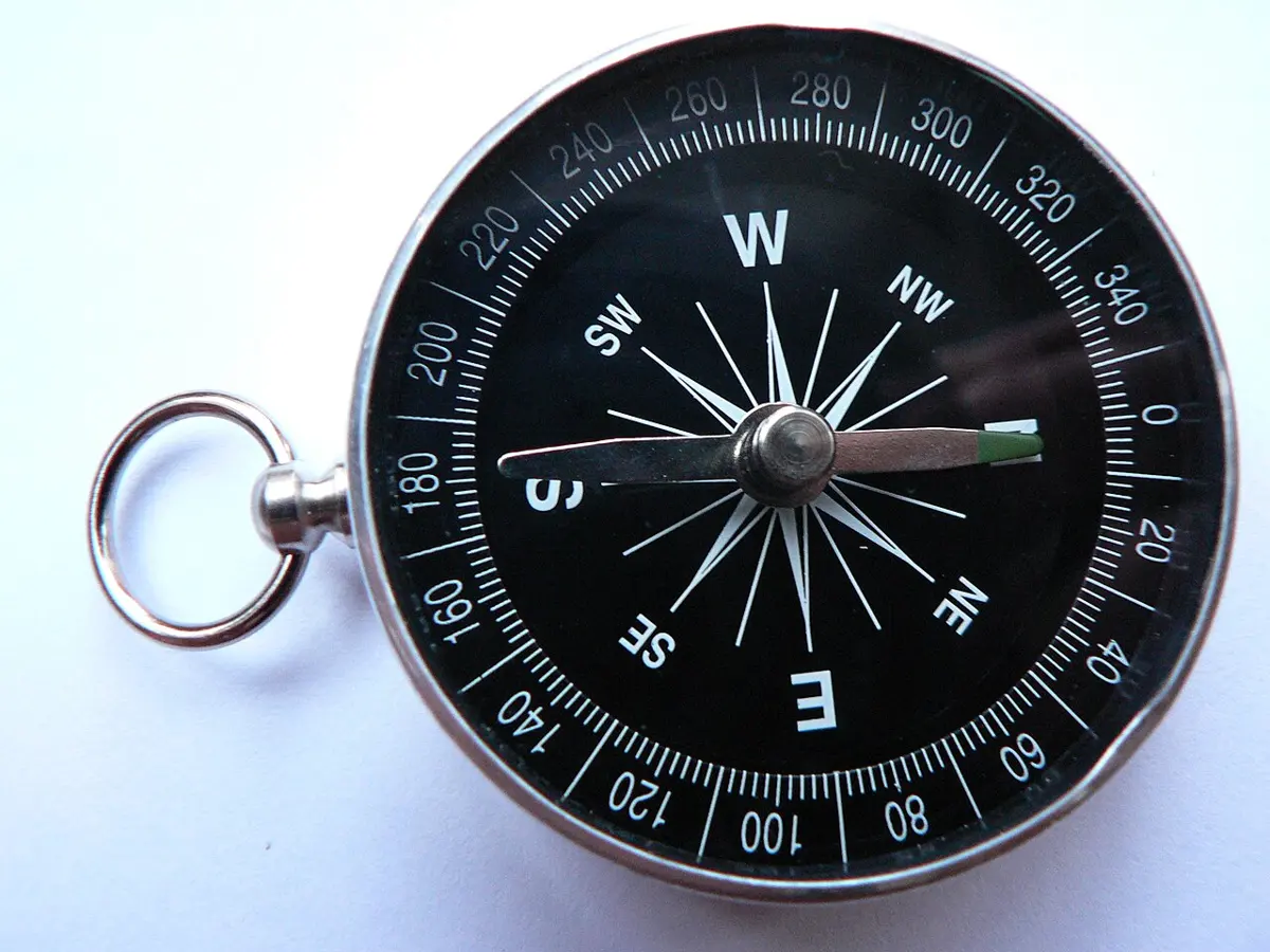
One detail: runway numbers count from magnetic north, the way a compass needle points, not from the map’s north. The two differ a little from place to place, and a runway is sometimes renumbered as the difference slowly changes.
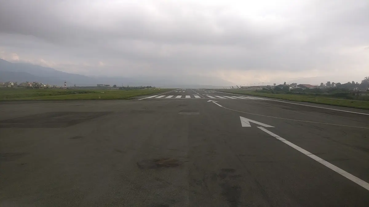
A runway’s number at one end is 09. What is painted at the other end?
Pick an answer to see why.
Where this is used
- Ships and airplanes. Routes are planned as a list of bearings and distances, exactly like the slips of paper in the game.
- Maps. Every map you trust has a scale. On a phone’s map, the bar changes as you zoom in.
- House plans. A plan is a scale drawing. Builders measure from it, so a mistake on paper can become a wall in the wrong place.
- Finding your way. With a compass, a map and the bearing of a far hilltop, you can keep walking straight even when the trees hide it.
How the exam asks it
The grid’s Grade 8 model paper asks for a bearing back, and its Grade 7 paper for a court drawn to a scale. This question is ours, with both of those and a map distance, the marks shared the way a teacher might. Read it as practice, not a prediction. Cover the answer and try it.
Where marks are lost
- Writing 50° for a bearing instead of 050°.
- Turning anticlockwise, so that a place to the north-west comes out as 45°.
- Measuring a bearing from the wrong place’s north line. Bearing of A from B: the north line goes at B.
- Leaving out the north line at a corner of a route.
- Forgetting to write the scale on a scale drawing.
- Mixing units: 1 : 100 with centimeters on the paper gives centimeters on the ground, not meters.
Exercise 20.2
Question 1
Rectangle ABCD is a scale drawing of rectangle EFGH. What scale is used?
Answer
Question 2
Here are two triangles on graphs.
- a.Draw a triangle half the size of each given triangle.
- b.Draw a triangle double the size of each given triangle.
- c.What is the relationship between the corresponding sides and angles of a given triangle and the triangle drawn to scale?
- d.What is the scale when the size was made half, and when it was doubled?
- e.What should the scale be to draw ten times smaller? Ten times bigger?
Hint
Answer
Question 3
Find the actual distance. The distance between two places on a map is 7 cm, and the scale is 1 cm = 750 m.
Answer
Find the actual distance. The distance between two places on a map is 6.5 cm, and the scale is 1 cm = 1,000 miles.
Answer
Find the actual distance. The distance between two places on a map is 3 cm, and the scale is 1 cm = 350 m.
Answer
What should the scale be to draw ten times smaller? Ten times bigger?
Answer
Question 4
Measure a side of the regular hexagon in the figure. It is drawn at the scale 1 : 200. Find the real length of its sides.
Answer
Question 5
Draw the map of a triangular rural municipality with sides of 15 km, 20 km and 25 km. Use a suitable scale.
Hint
Answer
Question 6
Madhav walks 5 km on a bearing of 030° from place A to reach place B. Then he walks 3 km on a bearing of 140° from B to reach place C. Finally he returns straight from C to A.
- a.Make a scale drawing with a suitable scale.
- b.What is the scale distance from place C to place A?
- c.What actual distance does he cover when he returns straight from C to A?
- d.Find the bearing of place A from place C.
Answer
Question 7
A temple lies 500 m south of the bus park of a city. A pond lies on a bearing of 030° from the temple, and on a bearing of 145° from the bus park. Use the scale 1 cm = 100 m to show this, and find the actual distance between the pond and the temple.
Hint
Answer
Question 8
Place A lies 400 m west of place B. The bearing of place C from A is 050°, and the bearing of C from B is 290°.
- a.Make a scale drawing, taking 1 cm = 40 m.
- b.What is the actual distance between B and C?
- c.Find the bearing of B from C.
Answer
Question 9
The figure shows the important places of a village, on squares of 1 cm. If 1 cm = 150 m, use a ruler to find the actual distance of these places from the post office.
- a.Temple
- b.Source of water
- c.Health post
- d.Market place (haat bazaar)
- e.School
Answer
Question 10
Renuka has made a map at the scale 1 cm = 500 m of the triangular path she walks every morning, from P to Q, to R and back to P. The squares are 1 cm.
- a.What distance does Renuka cover each day?
- b.What is the actual distance between the initial place P and the final place R?
- c.Find the bearing of place Q from place P.
- d.Find the bearing of place R from place Q.
- e.Find the bearing of the initial place P from the final place R.
Answer
Mixed exercise
These questions cover the geometry of Units 13 to 20.
Question 1
In the figure, the parallel lines AB and CD are cut by a transversal EF at the points M and N. Here , , and .
- a.Write two pairs of alternate angles and of corresponding angles.
- b.Are ∠BMN and ∠MND equal?
- c.Find the values of x, y and z.
Answer
Question 2
In the figure, ABCD is a square of side 4 cm, with , and .
- a.Write the formula for an exterior angle of a square.
- b.Find the values of x and y.
- c.Construct the square ABCD with a compass.
Answer
Question 3
In the figure, ABCD is a square of side 8 cm and AC is a diagonal.
- a.Write the formula for an interior angle of a square.
- b.Prove that .
- c.Find the area of △ABC.
Answer
Question 4
In the figure, AB and CD are parallel, and MN cuts them at E and F. G is a point on CD, joined to E.
- a.Write the name of the corresponding angle equal to ∠MEA.
- b.If , what is the value of x?
- c.If EF = FG, what is the value of y?
Answer
Question 5
Triangle PQR has vertices P(2, 3), Q(5, 1) and R(2, 1).
- a.Draw triangle PQR on a graph. Reflect it in the Y-axis, and write the coordinates of the vertices of the image.
- b.When the coordinates of P, Q and R are doubled, what is the length of P′Q′? Is it double the length of PQ? Write the reason with your calculation.
Answer
Question 6
The rectangle and parallelogram are equal in area. The rectangle’s length and breadth are 8 cm and 5 cm. The base of the parallelogram is 10 cm.
- a.Construct the rectangle ABCD with a compass.
- b.What is the height of the parallelogram?
- c.Does the area double when both the height and the base of the parallelogram are doubled? Write with a reason.
Answer
Question 7
A(1, 7), B(1, 1) and C(9, 1) are the vertices of △ABC.
- a.Find the coordinates of the image under a rotation through +90° about the origin. Show both triangles on the same graph.
- b.Find the length of side AC, using Pythagoras’ theorem.
- c.All congruent triangles are similar, but not all similar triangles are congruent. Justify this with an example.
Answer
Question 8
The figure shows a net of four equilateral triangles.
- a.Write the name of the solid formed by this net.
- b.How many axes of symmetry can an equilateral triangle have at most? Give an example with a reason.
- c.In this figure, the bearing of point Q from point P is 075°. What is the bearing of P from Q?
Answer
Question 9
The figure shows four samples of tessellation.
- a.Define regular and semi-regular tessellation.
- b.Sort these four tessellations into regular and semi-regular.
- c.Write the relationship between regular polygons and regular tessellations.
Answer
Question 10
In the figure, and AB = BC = CD = DE = EF = FA. ABCDEF has equal angles, and BC extended meets ER at T.
- a.What is the geometrical name of ABCDEF?
- b.Find the value of ∠CDT.
- c.Prove that △CDT is an equilateral triangle.
Answer
Printable PDFs
- Study notes 2 pages
- Harder practice questions 2 pages Answer key
Practice every question in the book, and keep track of the ones you miss →
Where these facts come from
- The exam (For the exam, How the exam asks it): CDC, विशिष्टीकरण तालिका (कक्षा ६-८) गणित – नमुना प्रश्नहरु (Geometry 15 marks in three questions; Grade 8 model question 11 b and Grade 7 model question 12 a, read on the PDF pages); our question is our own.
- The common mistakes, the question about roads in the sky, and the two ways of finding a bearing back: CDC, शिक्षक निर्देशिका कक्षा ८ गणित (२०८१), the lesson on bearing and scale drawing.
- The maps of Nepal and Kathmandu Valley: Nepal’s districts from the district map in our maps folder, the one the 77 Districts game uses; the Bagmati from the Survey Department’s rivers; hills from NASA’s SRTM elevation model; the zoo, the airport and Swayambhunath from Wikipedia’s coordinates, the other places from OpenStreetMap (ODbL), read November 2026. Bearings and distances worked out by
textbooks/make_bearing_maps.py. - Runway numbers, magnetic north and renumbering: Wikipedia, “Runway”; Kathmandu’s runway, its number and length: Wikipedia, “Tribhuvan International Airport”, read November 2026.
- Ways of writing a scale: Wikipedia, “Scale (map)”, read November 2026.
- A football ground’s size and center circle: Wikipedia, “Football pitch” (FIFA’s 105 m by 68 m), read November 2026.
- Nain Singh and Hari Ram: Wikipedia, “Nain Singh”, “Pundit (explorer)” and “Hari Ram (pundit)”, read November 2026.
- Every answer: worked out here and checked by a computer program. The measured figures are drawn from their bearings and lengths, so a protractor and ruler on them give these answers.
A companion to your textbook, not a replacement for it: study from the book your school uses, and where the two differ, follow your teacher. Found a mistake? Please tell us.