
Take a bus from Hetauda up to Daman and on towards Kathmandu, and in about two hours you climb from about 470 m to about 2,300 m. The tall sal trees of the valley floor give way to chilaune and pine, then to oaks hung with moss and lali gurans. Nobody planted these belts: the land and the climate sorted the trees by height long before anyone built the road. Which plants grow where in Nepal, how much forest is left, and how do we keep it?
This unit is about vegetation, the plant cover of a place. It begins with what vegetation does for the land, the water and us, then climbs Nepal from the Terai to the snow, belt by belt. It then looks at how much forest Nepal has today, the two ways of protecting plants and animals (in their home, or away from it), and what people do to the forests, for better and for worse.
5.1.1 Introduction
Vegetation is the plant life of a region or a habitat: all the kinds of plants growing there together, from tiny mosses and ferns on a wet rock to the tallest trees. A forest, a grassland, an alpine meadow and the cushion of moss on a temple wall are all vegetation.
Natural vegetation is a plant community that has grown up without help from people. It takes everything it needs from its surroundings and has been left untouched by human activities for a long time. Vegetation that has never been disturbed at all is called virgin vegetation. Crops in a field and fruit trees in an orchard are vegetation too, but they are not natural vegetation: people sow them, water them, weed them and harvest them.
In Nepal, three things decide the natural vegetation of a place more than anything else:
- climate, above all temperature and rainfall: the east of Nepal gets more rain than the west, and the land behind the Himalaya very little;
- altitude: the air gets colder by roughly 6 °C for every 1,000 m you climb, so height works like a change of latitude;
- slope and aspect (the way a slope faces): a south-facing slope gets more sun and dries out faster than a north-facing one at the same height, so the two often carry different forests.
Which of these is natural vegetation?
Pick an answer to see why.
Importance of vegetation
Vegetation does far more than look green. Its main roles in the biosphere (the part of the Earth where life exists):
- a.It drives the great cycles. Plants pull water from the soil and breathe it out through their leaves (transpiration), so a forest returns much of the rain to the air, and the clouds that form downwind fall as rain again. They take carbon dioxide from the air to build their bodies in photosynthesis, and give oxygen back. Plants with root nodules, such as beans and the alder trees (utis) of our hills, bring nitrogen into the soil. So vegetation regulates the water cycle, the carbon cycle and the nitrogen cycle.
- b.It shapes the soil. Roots break rock, dead leaves rot into humus, and the organic matter changes the soil’s depth, its chemistry and its texture (how crumbly it is). The soil, in turn, decides what can grow and how well: the two build each other.
- c.It is home and food for animals. Every animal’s food comes, in the end, from plants. A forest also gives shelter: nesting holes, shade, cover from predators.
- d.It feeds, houses and heals us: grain, fruit and vegetables; timber, bamboo and thatch; firewood; and medicines, from the bark of the willow (where aspirin began) to Nepal’s own herbs such as chiraito and timur.
- e.It holds the soil in place. Leaves catch the rain and let it drip down gently (interception); fallen leaves and roots keep the soil open so that the water soaks in (infiltration) instead of running off over the surface (overland flow) and carrying the soil with it. That is why bare hillsides wash away in the monsoon and forested ones mostly don’t.
A hill slope above a village is cleared of its forest. In the next monsoon, which change is most likely?
Pick an answer to see why.
5.1.2 Types of vegetation in Nepal
Nepal’s land rises from about 60 m above sea level in the Terai (the lowest point most books name is Kechana Kalan in Jhapa; survey maps show a spot in Dhanusha, Mukhiyapatti Musaharniya, a little lower, at about 59 m) to 8,848.86 m on top of Sagarmatha (Mount Everest; measured by Nepal and China in 2020, so older books give 8,848 m), within a distance of about 200 km. Climbing that height is like traveling from the tropics to the Arctic. So Nepal’s natural vegetation falls into belts by altitude, called bioclimatic zones, each with its own climate and its own plants. Dobremez drew finer lines, eleven zones; books that follow him group them into six main types, from the bottom up (Figure 16.1).
- a.Tropical forest (below about 1,000 m), in the Terai, the Bhabar, the Chure (Siwalik) hills and the inner Terai valleys such as Chitwan and Dang; about 14% of Nepal’s area lies in the Terai alone. The king of these forests is Shorea robusta (sal), tall and straight, with big leaves that are dropped for a short time in the dry spring. With it grow Terminalia alata (saj), Adina cordifolia (karma), Lagerstroemia parviflora (botdhayero) and Bombax ceiba (simal, red-flowered in spring). Along rivers, on new sand and gravel, grow Dalbergia sissoo (sisau) and Acacia catechu (khayar). Pinus roxburghii (chir pine, khote salla) grows on the higher, drier Chure ridges. Tall grasslands such as the phanta of Shuklaphanta and the floodplains of Chitwan are part of this belt too.
- b.Subtropical forest (about 1,000–2,000 m), in the lower Middle Hills, such as the slopes round the Kathmandu and Pokhara valleys. The main broadleaved forest is of Schima wallichii (chilaune) and Castanopsis indica (katus); sal still climbs into its lower part. On dry, south-facing slopes there are forests of Pinus roxburghii (chir pine), and Alnus nepalensis (utis) lines streams and fills landslide scars.
- c.Temperate forest (about 2,000–3,000 m), on the higher ridges of the Middle Hills and the Mahabharat. These are forests of evergreen oaks, Quercus lamellosa (phalant), Q. semecarpifolia (khasru) on drier slopes and, in the west, Q. leucotrichophora (banj), with Castanopsis tribuloides, maples and Rhododendron arboreum (lali gurans, Nepal’s national flower). Conifers form forests of their own: Pinus wallichiana (blue pine, gobre salla), Tsuga dumosa (hemlock) and, west of the Bheri River, Cedrus deodara (deodar).
- d.Subalpine forest (about 3,000–4,000 m), the highest forest, in the High Mountains. Its trees are mostly conifers that stay green all year, such as Abies spectabilis (fir, talis), with Betula utilis (Himalayan birch, bhojpatra, whose paper-thin bark was once written on) and tree rhododendrons such as R. campanulatum. Some books call this belt the temperate coniferous evergreen forest. At its top, around 4,000 m, the trees get shorter and twisted and then stop: this is the tree line.
- e.Alpine vegetation (about 4,000–5,000 m), above the tree line, cold and windswept, with snow for months. There are no trees: only low shrubs, some of them thorny, such as dwarf rhododendrons (Rhododendron anthopogon, sunpati, and R. lepidotum), junipers, barberry (Berberis) and Caragana, and meadows of grasses, sedges and flowering herbs such as the yellow Caltha palustris of wet places. These meadows are the summer pastures of yaks and sheep, and the home of yarsagumba.
- f.Nival or tundra vegetation (above about 5,000 m), the cold desert of snow, ice and bare rock. Only lichens, mosses and a few flowering plants pressed into low cushions survive on the rocks.
Above about 4,000 m in the Everest region you see only low shrubs and meadows, no trees. Which vegetation belt is this?
Pick an answer to see why.
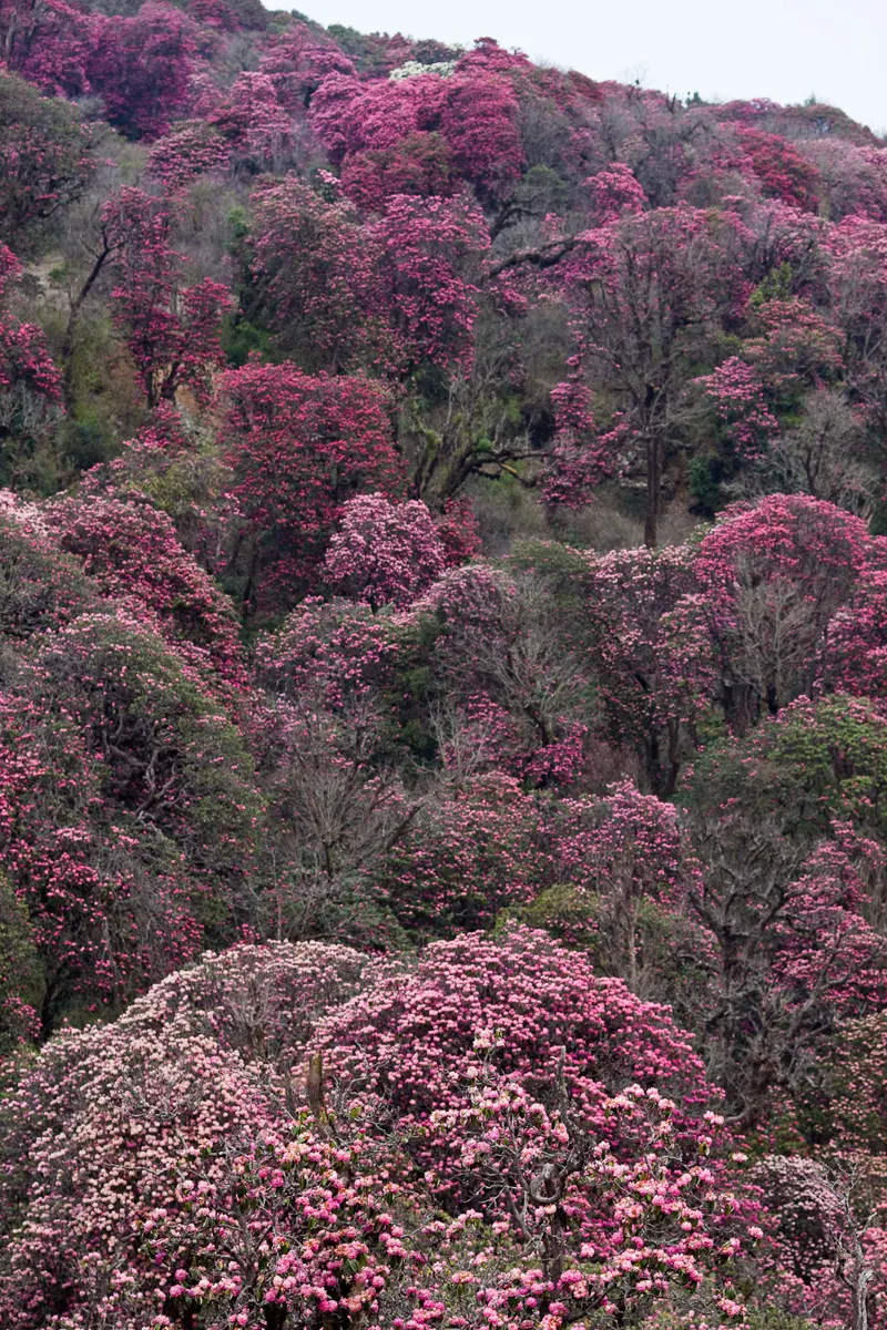
Present state of vegetation in Nepal
How much forest does Nepal have? The most complete count so far is the Forest Resource Assessment (FRA) Nepal, a five-year survey run by the government’s Department of Forest Research and Survey from 2010 to 2014 (2067 to 2071 BS), with field teams measuring trees in sample plots all over the country. It found:
- Forest covered about 40.4% of Nepal (5.96 million hectares).
- Another 4.4% was other wooded land, land with shrubs and scattered trees too sparse to count as forest.
- So forest and other wooded land together covered about 44.7%, close to half the country. This is the figure behind the “about 44%” that many books give.
Other studies, measuring differently, give a slightly different picture:
- A map made from satellite pictures of 2010 (Uddin and colleagues, published in 2015) found 39.1% of Nepal under forest and 29.8% under agriculture.
- That map also showed how broken up the forest is. About 23.4% of the forest was patch and edge forest: small patches, and the strips along the edges of bigger forests, where people, cattle and crops are close by. Inside the protected areas, 79.3% of the forest was core forest, well inside the forest and away from its edges; outside them, only 63% was.
- Nepal’s forests are managed in different ways: some inside national parks and other protected areas, many by local communities as community forests, and a small share mainly for timber as production forests.
- In the 1990s and early 2000s many feared the worst. An estimate of the UN’s Food and Agriculture Organization (FAO) said that between 2000 and 2005 Nepal was losing about 1.4% of its forest a year, about 530 km² a year.
The newest count tells a happier story. In 2022 the Forest Research and Training Centre found forest and other wooded land covering 46.1% of Nepal (43.4% forest and 2.7% other wooded land), up from 45.3% in 2019. Satellite maps from 1992 to 2016 show tree cover in the hills almost doubling. Most of it was not planted: the forests grew back by themselves once people looked after them (5.1.4).
FRA Nepal (2010–2014) found 40.4% of Nepal under forest and 4.4% under other wooded land. What does the figure “about 44%” describe?
Pick an answer to see why.
5.1.3 Concept of in-situ and ex-situ conservation
Conservation of natural vegetation means preserving and protecting the native plants, ecosystems and habitats of a place in their natural state. It tries to keep the plant communities, and the animals that live with them, diverse, healthy and in balance, using ways such as setting up protected areas, restoring damaged habitats, managing land sustainably and protecting biodiversity. Its goal is to save ecosystems from damage, loss of habitat and extinction, so that they survive and keep working for future generations.
There are two ways of conserving a species: protect it where it lives, or take some of it somewhere safe.
- a.In-situ conservation (Latin in situ, “in its place”) protects rare, endangered and threatened plants and animals in their own natural habitat, together with everything they live with. Examples: national parks, wildlife reserves, conservation areas, community forests.
- b.Ex-situ conservation (“out of its place”) protects them outside their natural habitat, usually because they are close to extinction and their home can’t keep them safe. Examples: botanical gardens, zoos, seed banks, safari parks, and in Nepal the Elephant Breeding Center at Khorsor, and the Gharial Conservation and Breeding Center and the Vulture Conservation and Breeding Center at Kasara, in and beside Chitwan National Park.
| In-situ conservation | Ex-situ conservation |
|---|---|
| in the species’ own natural habitat | outside its natural habitat |
| protects the whole ecosystem, every species in it | protects one or a few chosen species |
| the species keeps evolving with its surroundings | the species lives in conditions made by people |
| large areas; cheaper per species, but hard to guard against poaching and fire | small areas; costly, but every plant or animal can be watched, treated and bred |
| e.g. national parks, conservation areas, community forests | e.g. botanical gardens, zoos, seed banks, breeding centers |
The two work best together: a vulture chick bred at Kasara (ex-situ) is released over Nepal’s hills (in-situ), and only lives if the hills are safe for it.
Concept of in-situ conservation (protected areas)
Protected areas are special places that get extra care because they matter for nature, the environment or culture. A protected area is a clearly marked space on the map, known to everyone, and looked after through laws or other effective means, so that nature, with its ecosystems and its cultural values, stays safe for a long time. There are different kinds, and how strictly each is protected depends on the laws of the country and on international agreements. They include national parks, wildlife reserves, conservation areas, natural forests, community forests, religious forests (such as the forest round Pashupatinath and the sacred groves of many temples) and leasehold forests (handed to poor households to manage and earn from).
Protected areas of Nepal
Nepal’s protected areas mostly cover forest at every height, from the Terai through the hills to the high mountains. Nepal lies in the middle of the Himalaya: about 885 km long from east to west, with an area of 147,181 km², and from about 60 m in the Terai to 8,849 m on Sagarmatha.
That steep climb gives Nepal an extraordinary variety of life for its size. Nepal’s biodiversity plan (2014) counted about 6,973 species of flowering plants and about 5,000 of non-flowering plants, fungi, lichens and algae; and 208 mammals, 867 birds, 123 reptiles, 117 amphibians, 230 fishes and 651 butterflies. These counts keep rising as scientists find more.
To protect this, Nepal began a network of protected areas in 1973, with Chitwan, its first national park. By 2017 it had 20 protected areas: 12 national parks, 1 wildlife reserve, 6 conservation areas and 1 hunting reserve. Shuklaphanta and Parsa began as wildlife reserves and were made national parks in 2017. In August 2025 the government decided to make a 13th national park, Chhayanath, in Mugu, from part of Shey Phoksundo, and by October its office was being set up. Together with the buffer zones round the parks, where local people live and share the parks’ income, nearly a quarter of Nepal is protected (23.2% in 2014), one of the highest shares in Asia.
| Protected area | Kind | Set up | |
|---|---|---|---|
| 1 | Chitwan | national park | 1973 |
| 2 | Bardiya | national park | 1988 (a reserve from 1976) |
| 3 | Langtang | national park | 1976 |
| 4 | Sagarmatha | national park | 1976 |
| 5 | Rara | national park | 1976 |
| 6 | Shey Phoksundo | national park | 1984 |
| 7 | Khaptad | national park | 1984 |
| 8 | Makalu Barun | national park | 1992 |
| 9 | Shivapuri Nagarjun | national park | 2002 |
| 10 | Banke | national park | 2010 |
| 11 | Shuklaphanta | national park | 2017 (a reserve from the 1970s) |
| 12 | Parsa | national park | 2017 (a reserve from 1984) |
| 13 | Chhayanath | national park | 2025 |
| 14 | Koshi Tappu | wildlife reserve | 1976 |
| 15 | Annapurna | conservation area | 1992 |
| 16 | Kanchenjunga | conservation area | 1997 |
| 17 | Manaslu | conservation area | 1998 |
| 18 | Blackbuck (Krishnasar) | conservation area | 2009 |
| 19 | Api Nampa | conservation area | 2010 |
| 20 | Gaurishankar | conservation area | 2010 |
| 21 | Dhorpatan | hunting reserve | 1987 |
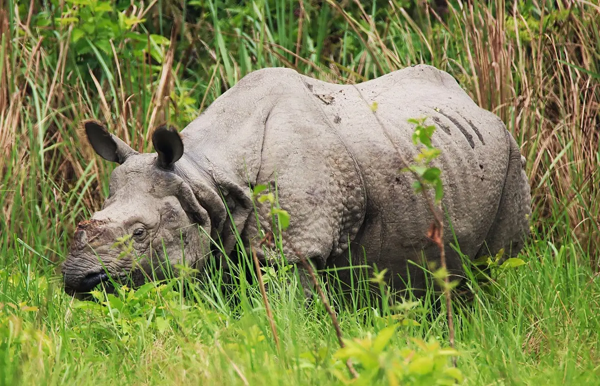
Ramsar sites
Wetlands, such as lakes, marshes, river floodplains and reservoirs, are among the richest and most threatened habitats on Earth. In 1971 countries meeting at Ramsar, in Iran, signed the Ramsar Convention, an agreement to look after wetlands. Each member country lists its wetlands of international importance, called Ramsar sites. Nepal joined in 1988 and has 10 Ramsar sites, named between 1987 and 2016:
| Ramsar site | District | Listed | |
|---|---|---|---|
| 1 | Koshi Tappu | Sunsari, Saptari, Udayapur | 1987 |
| 2 | Bishazari Tal (Beeshazar and associated lakes) | Chitwan | 2003 |
| 3 | Ghodaghodi Tal, home of the rare cotton pygmy goose | Kailali | 2003 |
| 4 | Jagdishpur Reservoir | Kapilvastu | 2003 |
| 5 | Gokyo Lakes | Solukhumbu | 2007 |
| 6 | Gosaikunda | Rasuwa | 2007 |
| 7 | Phoksundo Tal | Dolpa | 2007 |
| 8 | Rara Tal | Mugu | 2007 |
| 9 | Mai Pokhari | Ilam | 2008 |
| 10 | Lake Cluster of Pokhara Valley | Kaski | 2016 |
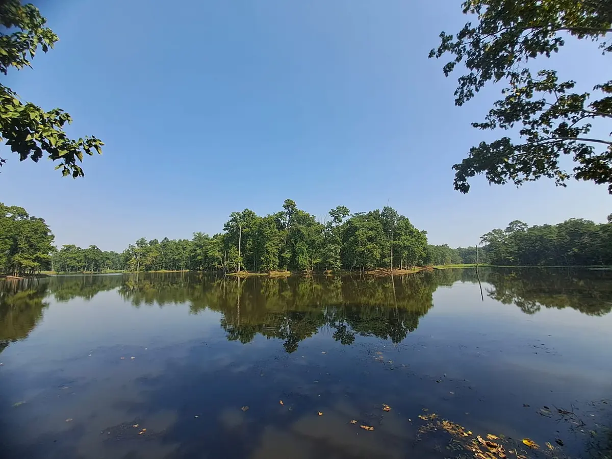
Which of these is a Ramsar site?
Pick an answer to see why.
Botanical garden (ex-situ conservation)
A botanical garden is a large area where many kinds of plants are grown, labeled and kept for science and education. The idea goes back to Theophrastus, the “father of botany”, who kept a garden at Aristotle’s school in Athens about 2,300 years ago. The first modern botanical gardens were made at Pisa (1544) and Padua (1545) in Italy, to grow medicinal plants for students of medicine. Today’s gardens also have greenhouses, research laboratories, libraries and herbariums (collections of pressed, dried and named plant specimens). The International Association of Botanic Gardens (IABG), founded in 1954, links them, coordinates research and helps them exchange plant material.
Importance of botanical gardens:
- a.They provide living plant material for systematic studies (identifying, naming and classifying plants).
- b.They grow the important plants of their own region.
- c.They keep records of the local flora.
- d.They supply seeds and plant material for research.
- e.They grow and preserve rare and endangered plants.
- f.In greenhouses whose temperature is controlled, they grow plants that couldn’t live outdoors there, or at that season.
Botanical gardens in Nepal, run by the Department of Plant Resources:
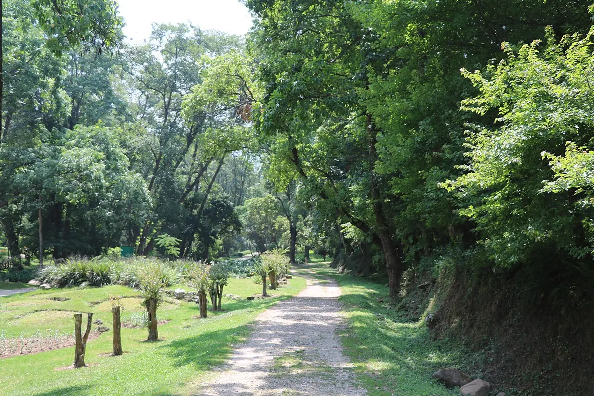
- a.National Botanical Garden, Godawari, Lalitpur (1962), the oldest and largest
- b.Brindavan Botanical Garden, Hetauda, Makwanpur
- c.Daman Botanical Garden, Makwanpur
- d.Tistung Botanical Garden, Makwanpur
- e.Dhanushadham Botanical Garden, Dhanusha
- f.Mai Pokhari Botanical Garden, Ilam
- g.World Peace Botanical Garden, Pokhara
- h.Dhakeri Botanical Garden, Banke
- i.Mulpani Botanical Garden, Salyan
- j.Dhitachaur Botanical Garden, Jumla
- k.Devariya Botanical Garden, Kailali
Spread from Ilam to Kailali and from the Terai to Jumla, each grows the plants of its own climate.
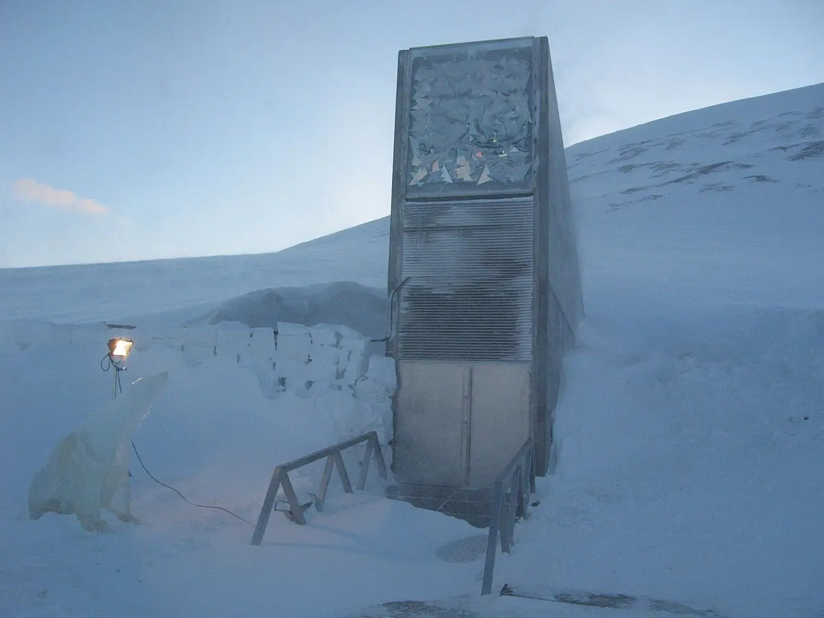
Seed bank (ex-situ conservation)
A seed bank, or germplasm bank, is a store kept at special conditions to keep the seeds of many kinds of plants, wild and cultivated, alive for a very long time. Its aim is simple: to save a wide variety of plants for future generations. (Germplasm means any living material that can grow a new plant: seeds, cuttings, tissue.)
Seed banks were first made for food crops, and they still hold the major crops such as cereals, soybean, cotton and many vegetables, but they now also store the seeds of many endangered wild plants.
How do you keep a seed alive for decades? Slow down its life. A dry seed is alive but resting (dormant), and the colder and drier it is kept, the more slowly it ages. The FAO’s standards for genebanks say that seeds for long-term storage should be dried (to a few percent of water) and kept at about −18 °C. At such conditions the seeds of many crops are expected to last for many decades, some for centuries.
Even so, seeds slowly die. So a seed bank tests samples from time to time by sowing them. If the share that germinates falls below about 85% of what it was at the start, the seeds are regenerated: some are sown, the plants are grown, and their fresh seeds are harvested and stored in place of the old ones.
Not every seed can be stored this way. The seeds of mango, litchi, jackfruit, tea and many tropical trees die if they are dried or frozen (they are called recalcitrant seeds). These are kept as living plants in field genebanks, or as tiny pieces of tissue in tubes.
Importance of seed banks. Extinction, by natural causes and by people, is a real threat, and once a species or a local variety is gone it is gone for ever. Seed banks guard against that, and they are part of the seed system that keeps a country fed:
- They keep the genes that plant breeders need to make crops with higher yields, resistance to disease and drought, better nutrition and more.
- They prevent the loss of genetic diversity in rare plants, conserving biodiversity outside the plants’ natural habitat (ex-situ).
Why are seeds in a seed bank kept dry and very cold?
Pick an answer to see why.
5.1.4 Natural environment: vegetation and human activities
The natural environment is everything around us that exists without people making it: plants, animals, soil, rocks, air, water and natural events such as rain and earthquakes. Living things and their surroundings together form ecosystems, which give people and every other living thing services they can’t do without, such as clean air, clean water and fertile soil.
People are changing the environment a great deal, through growing numbers, pollution, overuse of some resources and cutting too many trees. This brings problems such as climate change, soil erosion, polluted air and shortages of clean water. Building towns, farming, setting up factories and construction all change which plants grow where.
Deforestation
Deforestation is the loss of forest: an area’s trees are cut down or die and the land is turned to some other use, or left bare. It is the human activity with the biggest effect on vegetation, and it brings soil erosion and harm to the whole environment.
In the 1970s and 1980s many experts were sure that Nepal’s forests were vanishing. Estimates of the time said that around 100,000 hectares were being lost each year, and a World Bank report of 1979 warned that the forests people could reach in the hills would be largely gone by 1990, and those of the Terai by 2000. That didn’t happen. The forests of the hills have grown back, and forest and other wooded land now cover nearly half of Nepal (5.1.2). The warning was still useful, and the causes it named are real; where they are left unchecked, as in parts of the Terai and the Chure, forest is still lost.
Causes of deforestation
- Growing numbers of people and livestock need more food, land and forest products.
- Timber and firewood: wood for building and furniture, and firewood for cooking, have stripped many forests near towns and roads.
- Overgrazing: cattle, goats and sheep eat the young trees and trample the seedlings, so the forest can’t renew itself.
- Spreading farmland: forest is cleared for new fields, especially in the Terai.
- Building: roads, dams, towns and mines clear forest directly and open the forest round them to more cutting.
Hazards of deforestation
Forests matter enormously to the environment. Losing them causes:
- Soil erosion: on bare slopes the monsoon washes the topsoil away. Under a forest, the canopy breaks the force of the rain, fallen leaves cover the ground and roots hold the soil; on a bare slope the rain strikes the soil directly and runs off, carrying it away.
- Loss of fertility: the topsoil holds most of the nutrients, so the land left behind grows less.
- A changed climate: fewer trees take up carbon dioxide, and the carbon stored in the wood goes into the air when it burns or rots; less water is returned to the air, so local rainfall can change.
- Loss of habitat: the animals and plants of the forest lose their home.
- Floods and landslides: rain runs off faster, so streams rise faster, and slopes without roots slide more easily.
- Fewer forest products: less timber, firewood, fodder and medicinal herbs, which hurts the people and industries that depend on them, and Nepal’s economy.
Test plots in Nepal’s Middle Hills lost under 0.1 tonnes of soil per hectare a year under forest and over 15 tonnes on bare slopes. Roughly how many times more soil did a bare slope lose?
Pick an answer to see why.
Forest conservation or forest management
The forests can be protected and managed in many ways:
- Afforestation and reforestation: planting trees on a large scale, by the government and by local communities, on land that had no forest (afforestation) or had lost it (reforestation).
- Community forests: forests handed to the people who live beside them, who manage and protect them and share what they give.
- Private forests: landowners are encouraged, with help and seedlings, to plant trees on their own land.
- Modern pest control: controlling pests and diseases of trees in ways that don’t upset the forest’s natural balance, such as using their natural enemies.
- Agroforestry: growing trees together with crops, especially on less productive farmland; the trees give fodder, fruit and firewood and protect the soil.
- Strip plantation: planting rows of trees along roads, canals and railway lines.
- Alternative energy: biogas, electricity, LPG and improved stoves in place of firewood.
- Herbal farming: growing medicinal herbs in fields, so they needn’t be dug from the wild.
- Public awareness: teaching people why forests matter.
Exercise
A. Choose the correct option
- What does the term “vegetation” refer to in a general sense?
Pick an answer to see why.
- Why are cultivated crops and fruits not considered part of natural vegetation?
Pick an answer to see why.
- At what altitude range does the temperate coniferous evergreen forest (the subalpine forest of fir and birch) grow in Nepal?
Pick an answer to see why.
- What is the primary goal of in-situ conservation, such as national parks in Nepal?
Pick an answer to see why.
- According to the joint survey conducted from 2067 to 2071 BS, what percentage of Nepal’s land is covered by forest (with other wooded land)?
Pick an answer to see why.
- How does deforestation contribute to soil erosion?
Pick an answer to see why.
- What is the primary purpose of botanical gardens in Nepal?
Pick an answer to see why.
- What is the primary role of seed banks in preserving plant species?
Pick an answer to see why.
- How does deforestation affect the climate?
Pick an answer to see why.
- Which conservation method involves growing trees along with crops on less productive farmland?
Pick an answer to see why.
B. Answer the following questions
Define vegetation. Write one essential role of vegetation in the biosphere.
Answer
What is the altitude range of alpine vegetation in Nepal?
Answer
What is the main influence on the natural vegetation in Nepal?
Answer
What role does vegetation play in erosion control?
Answer
What is the primary goal of in-situ conservation?
Answer
Which bioclimatic zone in Nepal is characterized by subtropical forest?
Answer
What is the significance of protected areas in Nepal for biodiversity?
Answer
Describe the importance of vegetation in influencing soil characteristics.
Answer
List and briefly describe the types of natural vegetation in Nepal based on altitude.
Answer
Discuss the economic importance of vegetation in relation to the world economy.
Answer
Describe two types of conservation methods.
Answer
Briefly explain the importance of botanical gardens.
Answer
Differentiate between in-situ and ex-situ conservation of biodiversity.
Answer
Explain the concept of seed banks and their importance.
Answer
What is deforestation? Describe the causes and consequences of deforestation in the context of Nepal and suggest possible mitigating measures.
Answer
Printable PDFs
- Study notes 3 pages
- Worksheet 5 pages Answer key
Quiz yourself: Environment and Biodiversity, Grades 5–12 →
Practice every question in the book, and keep track of the ones you miss →
A companion to your textbook, not a replacement for it: study from the book your school uses, and where the two differ, follow your teacher. Found a mistake? Please tell us.