
Every year around the fifteenth of असार, late in June, people across the plains and hills of Nepal wade into flooded fields and press rice seedlings into the mud. They sing असारे गीत, the songs of the month, and afterward there is दही चिउरा, curd with beaten rice. Since 2004 the day has had an official name, राष्ट्रिय धान दिवस, National Paddy Day, and it is printed in calendars months ahead.
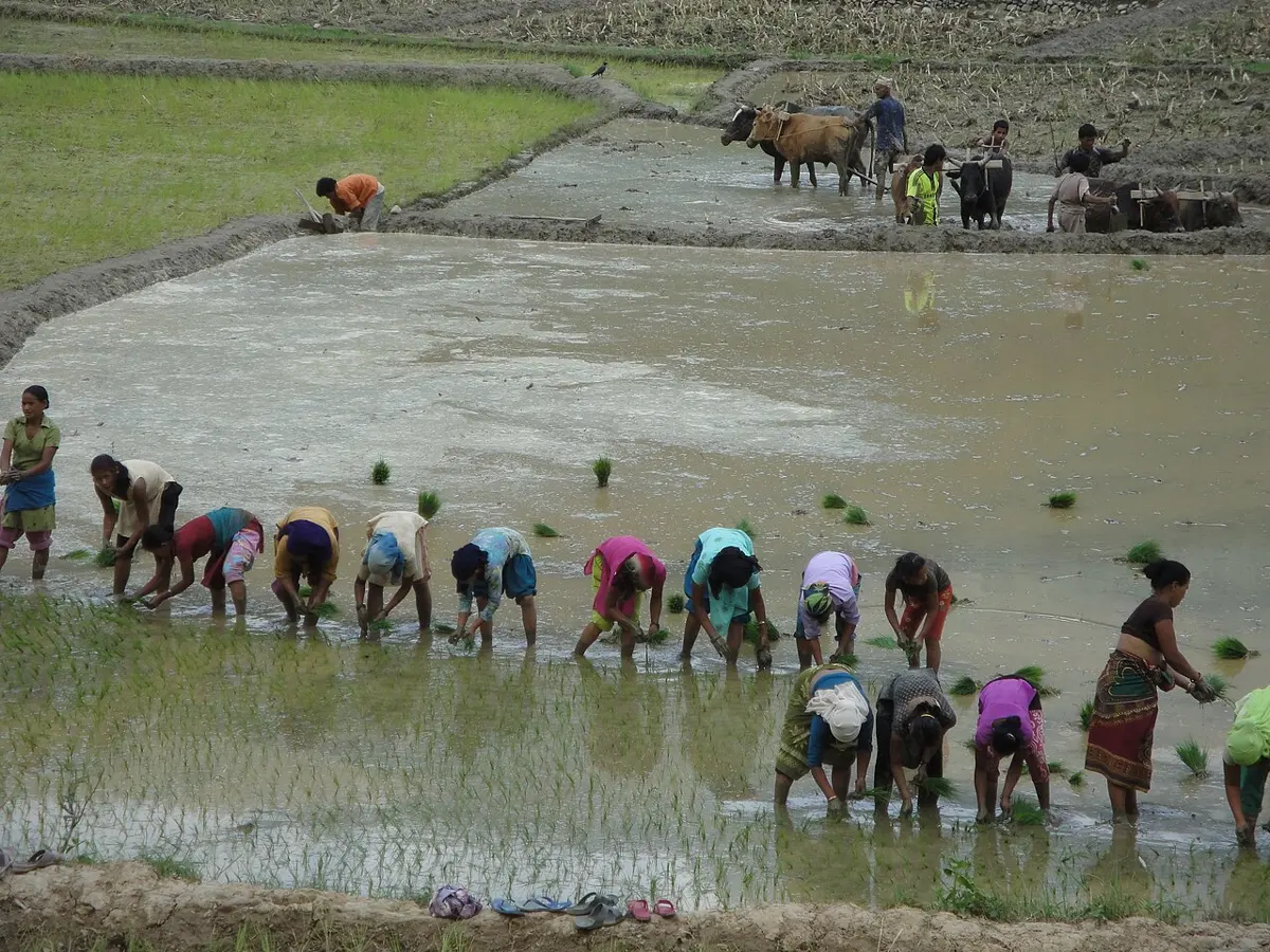
That’s a bold thing to print. Nobody can tell you if it will rain on a given day three weeks from now, yet a whole country plans its biggest job of the year around rain it hasn’t seen. And the rain turns up. The monsoon normally reaches eastern Nepal on 13 June, and in 45 of the 57 years up to 2024 it arrived within a week of that date.
Ordinary weather can’t keep a date like that. The monsoon can, because it runs on something much bigger than weather. Here’s how it works.
How it works
It starts with a tilt. The Earth leans to one side as it goes around the sun, so the sun’s strongest heat moves north of the equator in our summer and south of it in our winter. This happens every year, on schedule.
Around the middle of the Earth runs a great belt of rain. It is where warm, wet air rises. As air rises it cools, and cool air can’t hold as much water, so the belt is a long band of tall clouds and heavy rain. Scientists call it the Intertropical Convergence Zone, but “the rain belt” will do. It doesn’t stay in one place. It follows the sun’s heat, a little behind: north in our summer, south in our winter.
All that rising air has to be replaced, so air near the ground flows in toward the belt from both sides. That flow is wind. And here’s the part that matters for Nepal. In spring the belt is still near the equator. In June it swings north over India, and now the air flowing toward it from the south has come across the Indian Ocean, picking up water all the way. North of the equator the Earth’s spin bends moving air to the right, so air that set out heading north arrives from the southwest. That wet wind is the monsoon.
The wind carries its water north, raining as it goes, until the hills and the Himalaya stand in the way. The air has to climb, climbing cools it, and much more of the water falls as rain. That’s Nepal’s rainy season.
By the end of September the sun’s heat has moved south. The belt goes with it, the wet wind dies, and the wind turns around and blows dry from the land. Winter in Nepal is mostly dry.
So there are four steps. The sun’s heat moves north. The rain belt follows it. Wet wind from the ocean flows in toward the belt. Mountains squeeze out the water. The first step is set by the tilt of the Earth, which is why the date moves so little: the calendar and the rain are counting the same trip around the sun.
The same thing elsewhere
South Asia doesn’t have the only monsoon. If the rain belt is what drives it, the same thing should happen in other parts of the world, each in its season, and it does.
Over South Asia the heavy rain stays near the equator until May, jumps far north in June, and has gone again by October. West Africa has its own monsoon: the rain waits near the Guinea coast until June, then moves inland. Northern Australia has one too, six months later, because its summer comes in our winter. Scientists now see these as one worldwide swing of the rain belt, with each monsoon a local version of it.
The belt doesn’t creep north evenly. It jumps, and the reason seems to be this. When water vapor turns into rain, it gives off heat. That heat makes the air rise faster, which pulls in more wet air, which makes more rain. Once it gets going, the monsoon feeds itself, which helps explain why it bursts in on a place instead of building slowly.
Land helps. It warms faster than deep ocean, so the belt can travel much farther over a continent than over open sea. But wet air is what the belt really needs, not just hot ground. West Africa’s rain stops well short of the Sahara, even though the Sahara is among the hottest land on Earth. A desert has the heat and not the water.
Why it gets as far as Nepal
There’s a puzzle in all this. Monsoon rain belts usually reach about 10 to 25 degrees from the equator. Nepal lies between about 26 and 30 degrees north, so by rights the rain should stop before it gets here.
The answer is the mountains, though scientists still argue about exactly how. For a long time people thought the high Tibetan Plateau worked like a stove, heating the air above it and pulling the monsoon north. Since 2010 a different idea has gained ground, though not everyone accepts it: the mountains work like a wall. Far to the north lies cold, dry air. Without a barrier it would spill south and weaken the warm, wet air over India. With the Himalaya in the way, that air can stay warm and wet, and the rain belt can stay far to the north.
Nobody can remove the Himalaya to find out, so scientists do it on computers. The models don’t agree on every detail, but they lean the same way on the main point: take away the mountains and the heavy rain stays far to the south. Whatever else is true, Nepal’s rain depends on them.
East first, west last
The monsoon doesn’t reach all of Nepal at once. It comes in from the east.
Much of the wet air comes up the Bay of Bengal. When it reaches the corner where the Himalaya meet the hills of northeast India, it is turned west along the foot of the mountains. So eastern Nepal is nearest the source and gets the rain first, and the far west gets it last. That’s the usual explanation, though nobody has quite pinned it down by measurement.
The trip is different each year. In 2026 the monsoon arrived on 19 June and reached Gandaki and eastern Lumbini in three days. In 2025 it arrived on 29 May, took two weeks to get that far, and needed 23 days to cover the whole country.
Fifty-four kilometers
The mountains also decide who gets wet. Air climbing a mountainside drops much of its water on the way up, so the side the wet air reaches first gets soaked and the far side gets very little. The dry land behind the mountains is called a rain shadow.
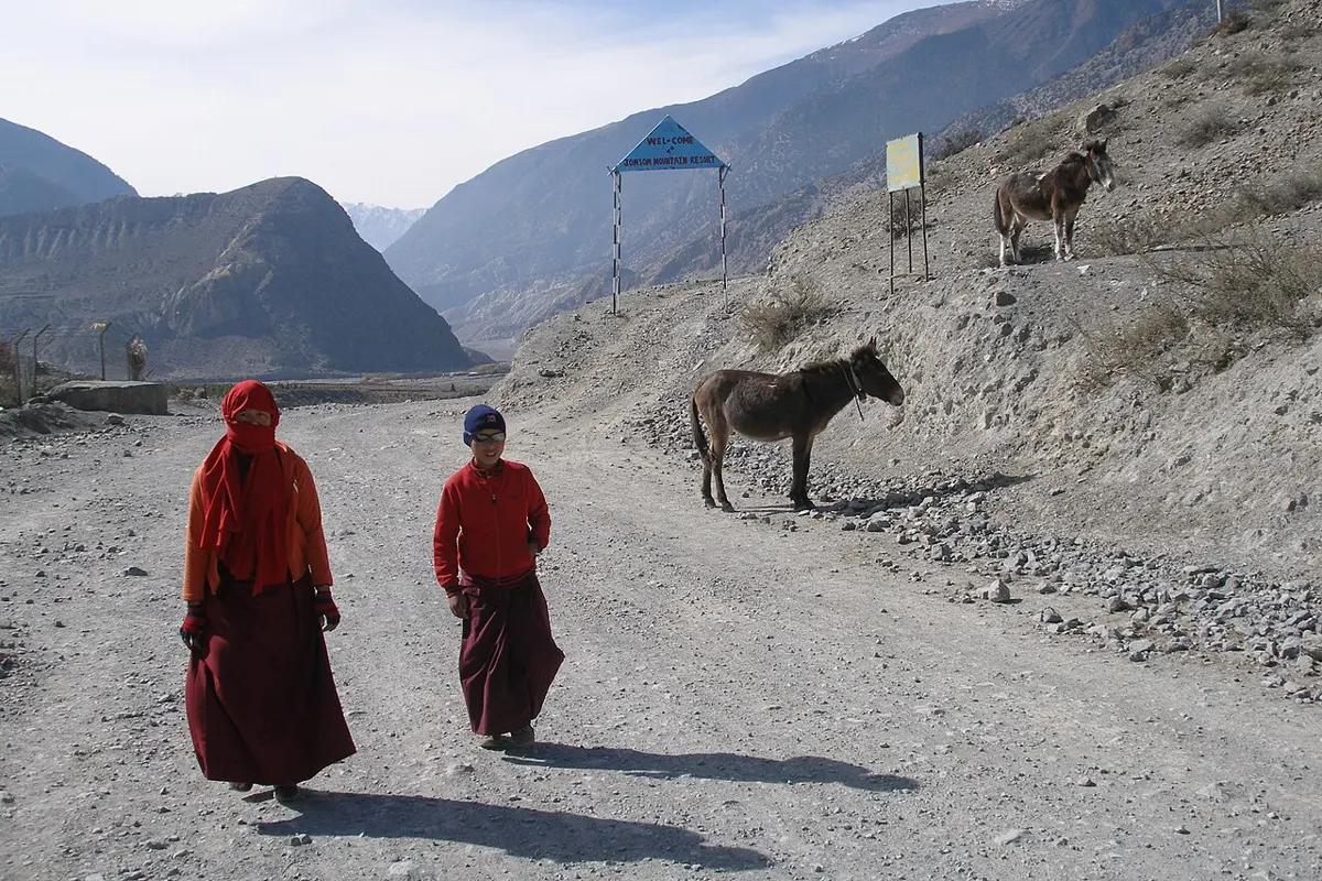
Nepal has a striking example. Lumle, on the south side of the Annapurna range, gets about 5,500 mm of rain in a normal year. If it all stayed where it fell, it would come up to the eaves of a two-story house. Jomsom, just 54 km away in a straight line but behind the range, gets about 290 mm. That wouldn’t reach your knee.
The sea breeze that isn’t
You may have learned a different explanation, because many books still give it. Stand on a beach on a sunny afternoon and you feel wind coming in off the water. The sand warms faster than the sea, the warm air rises, and cool sea air flows in underneath. In 1686 Edmund Halley, the man the comet is named for, suggested the monsoon was the same thing on a giant scale: in summer, hot Asia pulls in air from the cool ocean.
Part of that is true. The winds do turn around with the seasons, the water does come from the ocean, and land does get warmer than the sea in summer. But if hot land were pulling in the rain, the hottest time should be the rainiest. In 1921 the British meteorologist George Simpson pointed out that it isn’t: India is much hotter in May, before the monsoon, than in July, at its height.
Nepal’s plains show the same thing. At Bhairahawa the normal daily high peaks at 36.6 °C in May, with only 88 mm of rain that month. In July it’s down to 33.5 °C, with 498 mm. You already know why: a rainy day is cooler than a dry one. Cloud blocks the sun, and the sunlight that does get through goes into drying wet ground. For the most part the land’s heat isn’t making the rain. The rain is setting the land’s heat.
While it’s here, and after
Even in full flow the monsoon moves around. A long stretch of low pressure lies along northern India, and it swings north and south over days. When it swings up against the foothills, India’s rains pause, in what forecasters call a break, and the heavy rain falls along the foot of the Himalaya instead. A dry spell across much of India can be a flood in Nepal.
It has also been leaving later. From 1968 to 1996 the monsoon left eastern Nepal around 21 September on average, and from 1997 to 2024 around 6 October. The records show the change but not the reason.
After it goes, Nepal gets a second, smaller rain from the opposite direction. हिउँदे वर्षा, winter rain, comes with storms called western disturbances, carried east on the winter winds from as far away as the Mediterranean. So the two rains lean opposite ways: the monsoon favors the east, and winter rain favors the west.
Winter rain is only a few percent of the year’s total, but it comes when almost nothing else does, and wheat depends on it. When it failed in the winter of 2008–09, wheat and barley harvests fell about 15%.
What the date can’t promise
So the calendar can be trusted for the date, give or take a week, because the date comes from the Earth’s tilt. How much rain comes is another matter. The monsoon of 2024 brought 122% of normal. The season of 1979 lasted 73 days, and the season of 2022 lasted 134. Many of Nepal’s floods and droughts come from that difference.
The farmers have always known this. Planting on असार १५, a farmer in Chitwan told a reporter, is “a traditional norm but not a compulsion”. Another, in Dhading, put it more simply: “It all depends on the rainfall we get.”
Found a mistake? Please tell us.