
Set a phone to Delhi’s time and the clock drops back fifteen minutes. Set it to Dhaka’s and it jumps fifteen minutes ahead. Nepal’s clocks run 5 hours and 45 minutes ahead of the clocks at Greenwich, in London, and almost everywhere else on Earth the gap from Greenwich is a whole hour or a half. A quarter hour is rare. To see why Nepal has one, you need two things: a way of saying where any place is, and the fact that the Sun can’t be overhead everywhere at once.
The first is a grid. Every place on Earth has two numbers. Its latitude, अक्षांश in Nepali, says how far north or south of the equator it is, in degrees, from 0° at the equator to 90° at each pole. Its longitude, देशान्तर, says how far east or west it is of a line drawn from pole to pole through Greenwich, from 0° there to 180° on the far side of the world. Kathmandu is at about 27°43′ north and 85°19′ east. A degree is split into 60 minutes, and a minute into 60 seconds, the same words as on a clock. Your phone’s map writes the same numbers as decimals: 27.72, 85.32.
The second is the spin. The Earth turns once a day, from west to east, so the Sun seems to go once around the sky, all 360 degrees of longitude, in 24 hours. That is 15 degrees an hour, or one degree every four minutes. When the Sun stands highest over Kathmandu, it is still climbing for anyone farther west, and already sinking for anyone farther east. Noon by the Sun sweeps west across the world, and longitude is simply a way of saying how long it takes to reach you.
That is the whole idea. Clocks are another matter, because a clock has to agree with other clocks, and that is where the quarter hour comes from.
Two numbers for every place
The lines of latitude run around the Earth like rings, each one parallel to the equator, so they are also called parallels. They never meet. Going north by one degree takes about 111 km anywhere on Earth, give or take a kilometer for the Earth’s squashed shape. The lines of longitude, called meridians, run from pole to pole, and they all meet at the poles. So a degree of longitude is about 111 km at the equator, about 99 km at Kathmandu, and nothing at all at a pole, where every meridian ends in one point.
Latitude is the easy one to find, because the sky gives it away. The Pole Star sits less than a degree from the point in the sky that the Earth’s axis points at, so it never seems to move, and how high it stands above the horizon is your latitude. At the North Pole it is straight overhead, 90°. On the equator it sits on the horizon. In Kathmandu it is about 28° up, a little under a third of the way from the horizon to overhead. The noon Sun works too, by day. On the equinoxes, when the Sun is over the equator, its noon height is 90° minus your latitude: about 62° in Kathmandu. Sailors measured these angles for centuries and knew how far north or south they were.
Longitude is the hard one, and for a long time nobody at sea could find it. The sky looks the same from every place along a parallel; it just looks that way at different times. That is the clue. If you know what time it is at home and what time it is where you are, the difference is your longitude: one hour for every 15 degrees.
Finding the local time is easy. When the Sun is highest, it is noon where you are. The home time is the problem. A pendulum clock is useless on a rolling ship, and in 1714 the British Parliament offered £20,000 to anyone who could find longitude at sea to within half a degree. That meant a clock that kept time through heat, cold and storms, for weeks on end. John Harrison, a carpenter who had taught himself clockmaking, aimed for one that would gain or lose no more than three seconds a day, and spent 19 years on his third clock alone. His fourth, H4, looked like a large pocket watch. It sailed to Jamaica in 1761, and after about two months at sea it was only about five seconds slow. The whole story of the sea clocks is on the Inventions timeline.
Today a phone does it in a moment, from satellites. The grid hasn’t changed, only the speed of reading it.
Noon moves west
Here is the one sum this chapter needs, and it shows the difference between the Sun’s time and a clock’s.
Doha, in Qatar, is at about 51°32′ east. Kathmandu is at about 85°19′ east. Both are east of Greenwich, so the gap between them is the difference, 85°19′ − 51°32′ = 33°47′. Each degree is four minutes, so 33 degrees is 132 minutes, and each minute of longitude is four seconds, so 47′ is 188 seconds, a little over 3 minutes. Altogether about 135 minutes: 2 hours 15 minutes. Doha is to the west, so its noon comes later. When the Sun is highest over Kathmandu, Doha still has 2 hours 15 minutes to wait.
Now look at the clocks. Nepal’s are 5:45 ahead of Greenwich and Qatar’s are 3:00 ahead, so the clocks differ by 2 hours 45 minutes, half an hour more than the Sun does. Neither country sets its clocks by its own Sun. Each picks a line of longitude and makes its clocks show noon when the Sun is over that line: Qatar 45° east, and Nepal 86°15′ east. Between 45° and 86°15′ there are 41°15′, and that is 2 hours 45 minutes exactly.
So even in Kathmandu the Sun isn’t highest at 12:00. Kathmandu is a little under a degree west of Nepal’s line, so on average its noon comes about four minutes late, at about 12:04. Not every day, either. The Earth’s path around the Sun is slightly oval and its axis leans, so the Sun runs up to a quarter of an hour early or late through the year: in Kathmandu its noon comes as early as about 11:47 in early November and as late as about 12:18 in early February.
One clock for a whole country
For most of history every town kept its own time, and nobody minded. Noon was when the Sun was highest over the church tower or the palace, and the next town’s noon, a few minutes different, didn’t matter to anyone walking there.
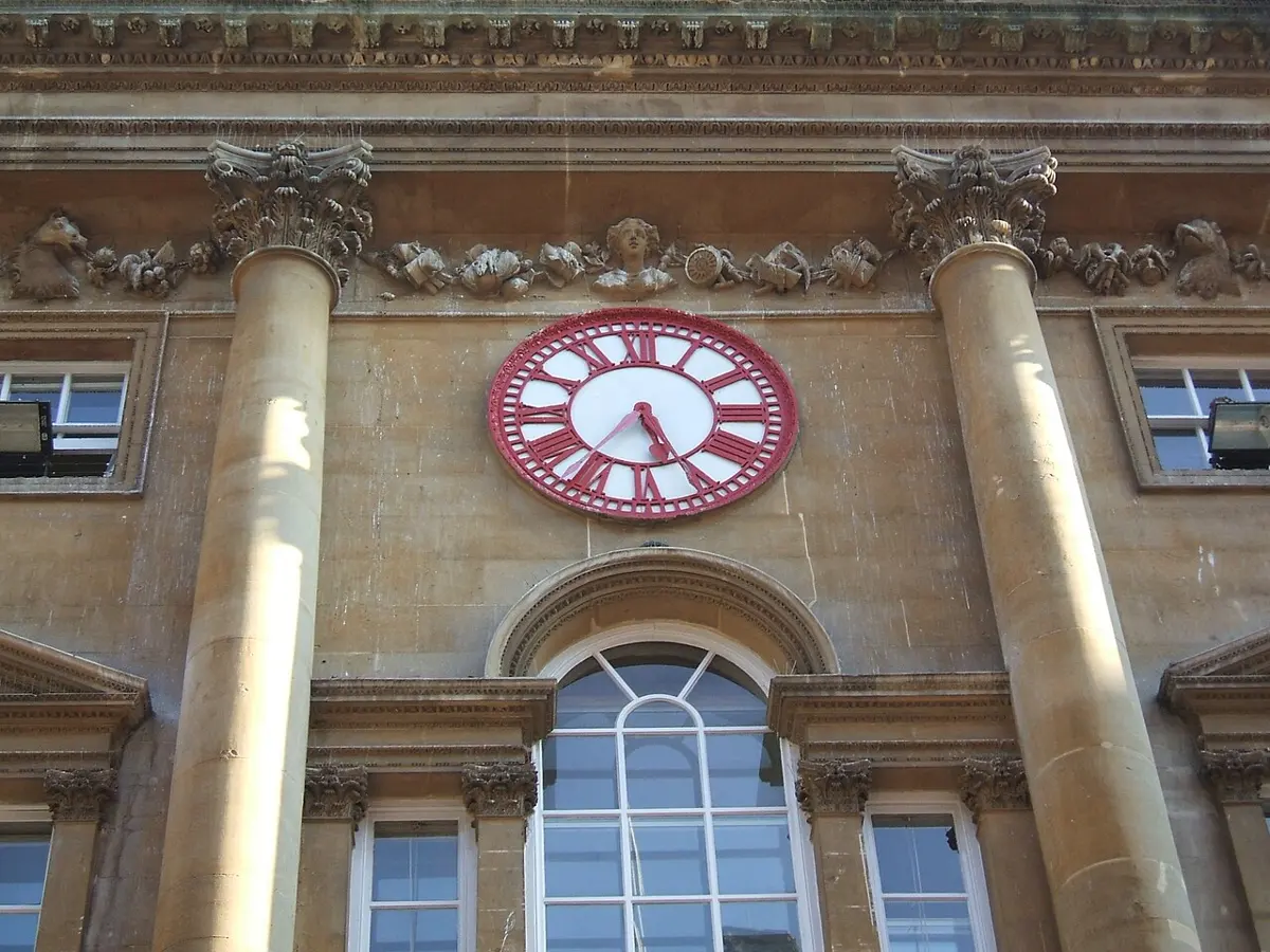
Railways changed that. A timetable needs one time along the whole line. In November 1840 the Great Western Railway in England began running its trains on London time, and in 1847 Britain’s railways agreed to do the same at every station. Bristol, about 10 minutes behind London by the Sun, put a second minute hand on the clock of its Corn Exchange, so people could read both times. Britain made London’s time the law in 1880. In North America the railways set their clocks to a few broad zones at noon on 18 November 1883, and in many towns that day had two noons, one by the Sun and one by the new time.
A year later, in October 1884, delegates from 26 countries met in Washington to choose one line from which the whole world would count longitude. Most of the world’s sea charts already counted from Greenwich, and the vote went to it, 22 to 1, with France and Brazil abstaining. The one vote against was San Domingo’s, today’s Dominican Republic. France went on counting from Paris for years. When it finally adopted the Greenwich time in 1911, its law didn’t say “Greenwich”: it called it Paris mean time, slowed by 9 minutes 21 seconds.
The meeting didn’t set up time zones, and nobody ever has, for the whole world at once. Each country chooses. The tidy plan is 24 zones, each 15 degrees wide, an hour apart, but countries draw their own lines, and their choices say as much about government as about geography.
China runs on one clock, Beijing’s, 8 hours ahead of Greenwich, since around 1949. In the far west, at Akto in Xinjiang, the Sun rises at about 10:16 by the clock on New Year’s Day. Xinjiang also has an unofficial local time, two hours behind, which some offices there use side by side with Beijing’s. Where China meets Afghanistan, at the Wakhjir Pass, the clocks jump by three and a half hours, the biggest jump on any border on land. India also uses one clock. Since 1906 it has kept the line 82°30′ east, which passes near Allahabad, now Prayagraj, and gives 5 hours 30 minutes ahead of Greenwich.
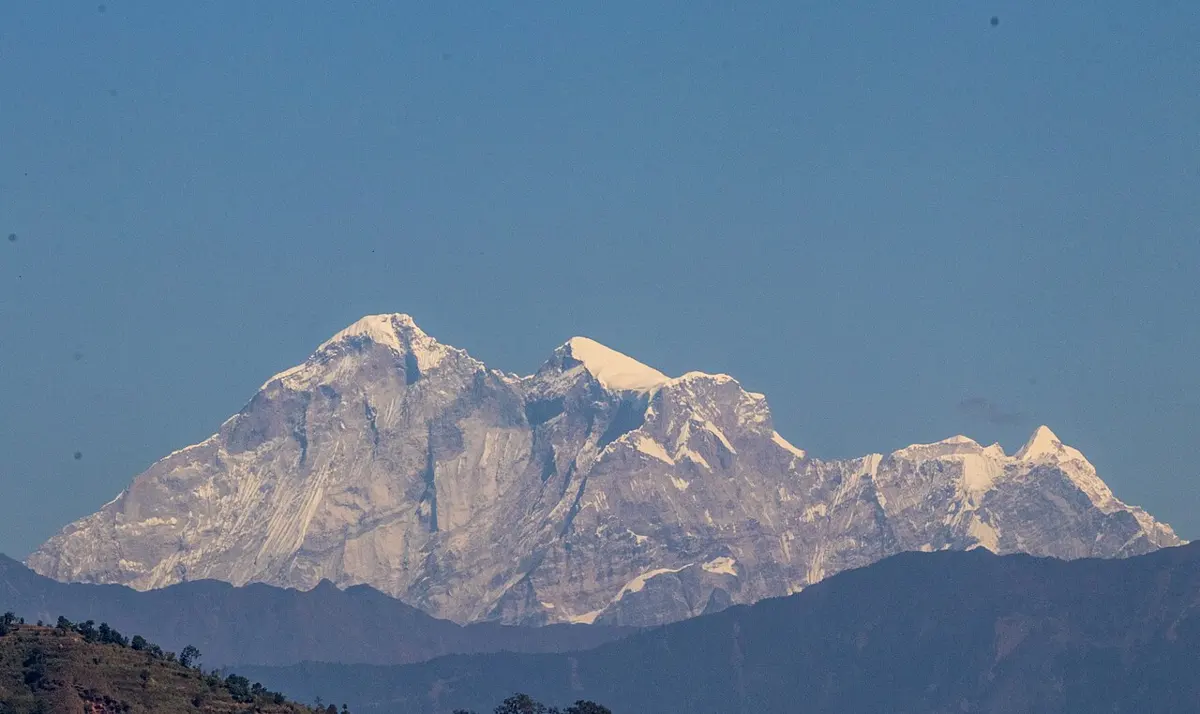
Nepal is narrower, about 8 degrees from Mahakali to Mechi, so the Sun takes a little over half an hour to cross it. Its clocks keep the line 86°15′ east, which passes a few kilometers west of the summit of Gaurishankar, in Dolakha. 86.25 degrees at four minutes a degree is 345 minutes: 5 hours 45 minutes. Kathmandu’s own Sun time is 5 hours 41 minutes ahead of Greenwich, and 5:45 is the quarter hour nearest to it. India’s line, three and three-quarter degrees west, is the quarter hour before it, 5:30.
So in the far east, near Kakarbhitta, the Sun is about 8 minutes ahead of the clocks, and at Mahendranagar, in the far west, about 24 minutes behind them. A school in Kanchanpur that starts at 10:00 starts, by the Sun, more than half an hour earlier in the day than one in Jhapa.
Nepal’s clocks haven’t always kept this line. From the early 1950s they ran 5 hours 40 minutes ahead of Greenwich, ten minutes ahead of India, which is the Sun’s time at 85° east, just west of Kathmandu. On 1 वैशाख 2042, New Year’s Day, 13 April 1985, they moved forward five minutes, to 5:45. The head of the Survey Department, who announced the change, gave two reasons, as a news report of the time tells it: a quarter hour would sit better beside other countries’ times, and the new line lay closer to a sacred peak. The report doesn’t name the peak, but the line at 86°15′ runs just west of Gaurishankar. Only two other places keep a quarter hour like Nepal’s: the Chatham Islands of New Zealand, 12 hours 45 minutes ahead of Greenwich, and a small corner of southern Australia around Eucla, where people keep an unofficial 8:45.
Where the day begins
There is a catch in all this, and the first people to find it were sailors who went all the way around.
In 1519 five ships left Spain under Ferdinand Magellan, sailing west for the spice islands. One came home, three years later, with 18 men. On the way back they called at the Cape Verde Islands, off Africa, and the men sent ashore in a boat for food were told to ask what day it was. The answer was Thursday. “We were greatly surprised for it was Wednesday with us,” wrote the expedition’s chronicler, Antonio Pigafetta, “and we could not see how we had made a mistake; for as I had always kept well, I had set down every day without any interruption.”
He hadn’t made a mistake. Sailing west, they had been following the Sun, so each of their days was a little longer than a day at home. All the way around, those little bits added up to exactly one day: they had seen one sunrise fewer than the people who stayed behind. Travel east around the world and you see one sunrise more, which is how Phileas Fogg, in Jules Verne’s Around the World in Eighty Days, arrives a day early without knowing it.
So somewhere the calendar has to jump. That place is the International Date Line, which runs roughly along 180°, through the middle of the Pacific, where it crosses as little land as possible. Cross it going west and you skip a day; cross it going east and you live one day twice. No treaty fixes where it runs. Each country on its edge decides which side it is on, so the line zigzags around island groups.
Some have changed sides. At the end of 1994 Kiribati, whose islands straddled the line, moved it around all of them, and skipped Saturday 31 December. In 2011 Samoa found that being nearly a day behind Australia and New Zealand, its main trading partners, left only four working days a week in common. It moved to their side of the line, and Thursday 29 December 2011 was followed by Saturday 31 December. Friday never happened in Samoa that year.
Because countries choose, the clocks don’t stop at 12 hours either side of Greenwich. The Line Islands of Kiribati are 14 hours ahead, the first place where each new day begins. Baker and Howland Islands, in the middle of the Pacific, are 12 hours behind, the last place where it ends. Between them lie 26 hours, so for two hours of every day there are three different dates on Earth at once.
The other side of the Earth
Push a stick straight down through the middle of the Earth, and it comes out at the point exactly opposite you, your antipode. CDC’s word for it is प्रतिलोम. Finding it takes two steps. Keep the latitude but swap north for south. Take the longitude away from 180°, and swap east for west. Kathmandu, at 27°43′ N and 85°19′ E, is opposite 27°43′ S and 94°41′ W.
Everything there is upside down from here. Its Sun time is 12 hours from Kathmandu’s, so its noon is Kathmandu’s midnight. Its seasons are opposite, so its winter is in June. And it is in the sea. Kathmandu’s antipode is in the open Pacific, about 1,070 km east of Salas y Gómez, a bare Chilean rock less than a kilometer long, about 1,450 km east of Easter Island and about 2,350 km west of the coast of Chile. Nowhere in Nepal does better: the point opposite every part of the country is ocean, at least 900 km from any land.
That is the usual luck. Most of the Earth’s land sits in one half of the globe, so most of it has sea on the other side; counting from a world map, only about one part in eight of the land has land opposite. The famous pairs are where the two meet. Madrid’s antipode is on the North Island of New Zealand. Beijing’s and Shanghai’s are in Argentina. Americans have long talked about digging a hole to China, but from almost anywhere in the forty-eight states between Canada and Mexico, the hole would come out in the Indian Ocean. Only a few small patches, in Montana and Colorado, sit opposite land: France’s Kerguelen, Amsterdam and Saint-Paul islands, far out in that ocean.
To try it from anywhere, The Other Side of the Earth on Our World finds the point opposite any place you tap. Time Zones shows every zone on a globe with day and night as they are right now, and a clock to move noon around the world. Why Do Flights to America Fly Near the North Pole?, in Going Further, follows the grid to the shortest way between two places, which is rarely along a line of latitude. In Nepali, Grade 6’s सामाजिक book introduces the grid in अक्षांश र देशान्तर, and Grade 9’s works out the time between two places step by step in देशान्तरबाट समय निकाल्ने तरिका.
So the clock on a phone in Nepal carries a little geography of its own: a line of longitude chosen near a mountain in Dolakha, a country that decided not to share India’s time, and a quarter hour that most of the world doesn’t use.
Found a mistake? Please tell us.